IMAGES TAKEN NEAR TO
Garth Grove, ILKLEY, LS29 6LJ
Introduction
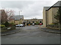
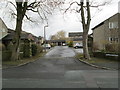
This page details the photographs taken nearby to Garth Grove, LS29 6LJ by members of the Geograph project.
The Geograph project started in 2005 with the aim of publishing, organising and preserving representative images for every square kilometre of Great Britain, Ireland and the Isle of Man.

There are currently over 7.5m images from over14,400 individuals and you can help contribute to the project by visiting https://www.geograph.org.uk
Image Map
Images are licensed for reuse under creativecommons.org/licenses/by-sa/2.0
Notes
- Clicking on the map will re-center to the selected point.
- The higher the marker number, the further away the image location is from the centre of the postcode.
Image Listing (83 Images Found)
Images are licensed for reuse under creativecommons.org/licenses/by-sa/2.0
Image
Details
Distance
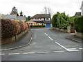
3
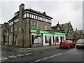
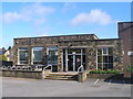
The co-operative food - Main Street
Image: © Betty Longbottom
Taken: 17 Apr 2013
0.05 miles
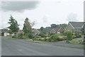
6
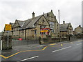
Menston Primary School - Main Street
Built as a Board School in the 1890s.
Image: © Betty Longbottom
Taken: 17 Apr 2013
0.07 miles