IMAGES TAKEN NEAR TO
Moorview Croft, ILKLEY, LS29 6EZ
Introduction
This page details the photographs taken nearby to Moorview Croft, LS29 6EZ by members of the Geograph project.
The Geograph project started in 2005 with the aim of publishing, organising and preserving representative images for every square kilometre of Great Britain, Ireland and the Isle of Man.

There are currently over 7.5m images from over14,400 individuals and you can help contribute to the project by visiting https://www.geograph.org.uk
Image Map
Images are licensed for reuse under creativecommons.org/licenses/by-sa/2.0
Notes
- Clicking on the map will re-center to the selected point.
- The higher the marker number, the further away the image location is from the centre of the postcode.
Image Listing (66 Images Found)
Images are licensed for reuse under creativecommons.org/licenses/by-sa/2.0
Image
Details
Distance
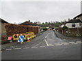
3

Fairfax Club - Main Street, Menston
Image: © Betty Longbottom
Taken: 15 Aug 2008
0.03 miles
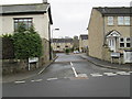
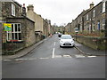
7
Main Street - viewed from Bleach Mill Lane
Image: © Betty Longbottom
Taken: 17 Apr 2013
0.06 miles
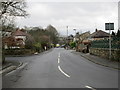
8
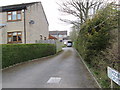
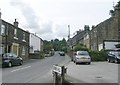
Bleach Mill Lane at its junction with Moor Lane in Menston
Looking north-westward.
Image: © Peter Wood
Taken: 11 Aug 2017
0.07 miles
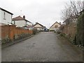
9
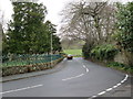
Moor Lane - viewed from Main Street
Image: © Betty Longbottom
Taken: 17 Apr 2013
0.07 miles
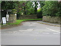
10
Derry Hill - Main Street, Menston
Image: © Betty Longbottom
Taken: 15 Aug 2008
0.07 miles