
IMAGES TAKEN NEAR TO
Bingley Road, ILKLEY, LS29 6BB
Introduction
This page details the photographs taken nearby to Bingley Road, LS29 6BB by members of the Geograph project.
The Geograph project started in 2005 with the aim of publishing, organising and preserving representative images for every square kilometre of Great Britain, Ireland and the Isle of Man.

There are currently over 7.5m images from over14,400 individuals and you can help contribute to the project by visiting https://www.geograph.org.uk
Image Map
Images are licensed for reuse under creativecommons.org/licenses/by-sa/2.0
Notes
- Clicking on the map will re-center to the selected point.
- The higher the marker number, the further away the image location is from the centre of the postcode.
Image Listing (28 Images Found)
Images are licensed for reuse under creativecommons.org/licenses/by-sa/2.0
Image
Details
Distance
1
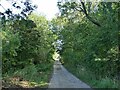
Access road to High Royds Hall
The hall is in the other direction. The road is a public footpath south of this point but the right of way diverges here across a field to the left.
Image: © Stephen Craven
Taken: 26 Sep 2020
0.04 miles
2
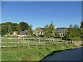
Home Farm, Menston
These buildings appear to have been converted to private housing rather than being a working farm. The reason for its abandonment may be connected with the former High Royds mental hospital nearby, as explained in the following text found online (source - http://www.highroydshospital.com/insight/farming-the-land-g-w-bitton/ ):
"The site of High Royds in the rich Yorkshire countryside of Lower Wharfedale, and the importance given from the very earliest days to the concept of a self-sufficient community, meant that farming and the needs of the land were a central feature of life in the institution. In total there were four separate farms – Thorpe, Norcroft, Odda and Home Farm – with over 600 acres of land. Local men were employed to do much of the farm labour, and were paid an extra supplement for working alongside the patients. Tasks undertaken by patients were usually fetching and carrying churns of milk and sacks of grain, as well as helping to look after the animals. ... The pigs and milk were at Holme Farm [sic], rearing stock at Norcroft, older stock at Odda and dried off cows at Thorpe until they came into milk again."
Image: © Stephen Craven
Taken: 26 Sep 2020
0.04 miles
3

Field path to High Royds Hall access track
The path has come from Bingley Road and beyond High Royds Hall a path can be followed to Hawksworth.
Image: © Kevin Waterhouse
Taken: 7 Aug 2025
0.05 miles
4
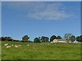
Sheep in a field off Bingley Road
The house in the background is called High Ash.
Image: © Stephen Craven
Taken: 26 Sep 2020
0.07 miles
5
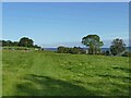
Footpath across a field off Bingley Road
Between here and the road is the Leeds/Bradford borough boundary.
Image: © Stephen Craven
Taken: 26 Sep 2020
0.08 miles
6
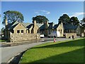
Older buildings at the end of Norwood Avenue
These houses were probably associated with the adjacent Home Farm rather than the nearby High Royds hospital - although the two were connected, patients from the hospital providing labour for the farm.
Image: © Stephen Craven
Taken: 26 Sep 2020
0.10 miles
7
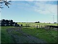
Bales in a field at High Royds
Adjacent to the access road to High Royds Hall which is a public footpath at this point.
Image: © Stephen Craven
Taken: 26 Sep 2020
0.10 miles
10
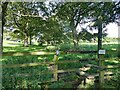
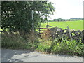
Permissive path at High Royds
The footpath links the perimeter path of the new Chevin Park estate Image with the access road to High Royds Hall.
Image: © Stephen Craven
Taken: 26 Sep 2020
0.13 miles