
IMAGES TAKEN NEAR TO
Parsons Lane, ILKLEY, LS29 0FA
Introduction
This page details the photographs taken nearby to Parsons Lane, LS29 0FA by members of the Geograph project.
The Geograph project started in 2005 with the aim of publishing, organising and preserving representative images for every square kilometre of Great Britain, Ireland and the Isle of Man.

There are currently over 7.5m images from over14,400 individuals and you can help contribute to the project by visiting https://www.geograph.org.uk
Image Map
Images are licensed for reuse under creativecommons.org/licenses/by-sa/2.0
Notes
- Clicking on the map will re-center to the selected point.
- The higher the marker number, the further away the image location is from the centre of the postcode.
Image Listing (12 Images Found)
Images are licensed for reuse under creativecommons.org/licenses/by-sa/2.0
Image
Details
Distance
1
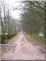
Parson's Lane
Rough lane descending towards Addingham, bordered by drystone walls and lined with sycamore trees.
Image: © Gordon Hatton
Taken: 5 Mar 2011
0.09 miles
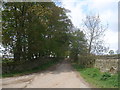
3
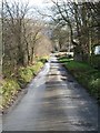
Moor Lane Addingham
The section of lane above the village. The lane once ran straight into Addingham, but the construction of the A65 by-pass has resulted in a diversion.
Image: © Gordon Hatton
Taken: 26 Nov 2018
0.13 miles
4
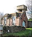
Derelict building on Moor Lane
I think one can safely assume that this brick structure was once something to do with the local water supply, the elevated storage tank behind being a major clue, although there are no clues on old 6" or 25" maps of the area.
Image: © Gordon Hatton
Taken: 26 Nov 2018
0.15 miles
5
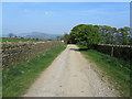
Parson's Lane
Well made walled track leading to Addingham from the south west
Image: © Chris Heaton
Taken: 20 Apr 2011
0.17 miles
7
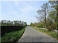
Crossbank Road, Addingham
No through road that runs parallel and slightly to the west of the A65, Addingham by pass
Image: © Chris Heaton
Taken: 20 Apr 2011
0.20 miles
8
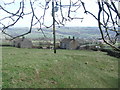
Cross Bank.
Looking E from the former farm to the W.
Image: © Steve Partridge
Taken: 16 Apr 2006
0.23 miles
9
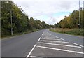
Addingham Wharfedale Road - viewed from Silsden Road
Image: © Betty Longbottom
Taken: 13 Oct 2015
0.23 miles
10
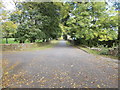
Turner Lane - off Addingham Wharfedale Road
Image: © Betty Longbottom
Taken: 13 Oct 2015
0.24 miles