
IMAGES TAKEN NEAR TO
Womersley Place, PUDSEY, LS28 8QB
Introduction
This page details the photographs taken nearby to Womersley Place, LS28 8QB by members of the Geograph project.
The Geograph project started in 2005 with the aim of publishing, organising and preserving representative images for every square kilometre of Great Britain, Ireland and the Isle of Man.

There are currently over 7.5m images from over14,400 individuals and you can help contribute to the project by visiting https://www.geograph.org.uk
Image Map
Images are licensed for reuse under creativecommons.org/licenses/by-sa/2.0
Notes
- Clicking on the map will re-center to the selected point.
- The higher the marker number, the further away the image location is from the centre of the postcode.
Image Listing (312 Images Found)
Images are licensed for reuse under creativecommons.org/licenses/by-sa/2.0
Image
Details
Distance
3
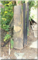
Bench Mark Gatepost of No12 Carlisle Road
BM description details https://www.bench-marks.org.uk/bm125977
Image: © OfficeOfPudseyBMs
Taken: 14 Jun 2020
0.03 miles
4
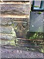
Benchmark on Greenside Primary School, Carlisle Road, Pudsey
Benchmark description https://www.bench-marks.org.uk/bm138678
Image: © OfficeOfPudseyBMs
Taken: 1 Jan 2021
0.04 miles
5
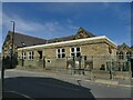
Greenside School, Carlisle Road, Pudsey
A modern flat-roofed extension hides part of the original building. See Image for the main frontage to Chapeltown.
Image: © Stephen Craven
Taken: 21 Aug 2022
0.04 miles
6
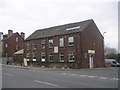
E L Schofield Furniture - Carlisle Road
Image: © Betty Longbottom
Taken: 19 Mar 2011
0.04 miles
9

Greenside primary school, Pudsey
See also Image
Image: © Stephen Craven
Taken: 22 Aug 2016
0.05 miles
10
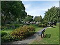
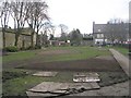
Pocket park, Chapeltown, Pudsey
If there is a local name for this little park, I don't know it. Image shows an early stage of development of the park in 2011. Old maps show terraced housing on this site, probably demolished some time after World War II.
Image: © Stephen Craven
Taken: 21 Aug 2022
0.05 miles