IMAGES TAKEN NEAR TO
Bradford Road, PUDSEY, LS28 6DX
Introduction
This page details the photographs taken nearby to Bradford Road, LS28 6DX by members of the Geograph project.
The Geograph project started in 2005 with the aim of publishing, organising and preserving representative images for every square kilometre of Great Britain, Ireland and the Isle of Man.

There are currently over 7.5m images from over14,400 individuals and you can help contribute to the project by visiting https://www.geograph.org.uk
Image Map
Images are licensed for reuse under creativecommons.org/licenses/by-sa/2.0
Notes
- Clicking on the map will re-center to the selected point.
- The higher the marker number, the further away the image location is from the centre of the postcode.
Image Listing (435 Images Found)
Images are licensed for reuse under creativecommons.org/licenses/by-sa/2.0
Image
Details
Distance

2

Oakdene, Sunfield Close, Stanningley, Leeds
Image: © Mark Stevenson
Taken: 9 Jun 2015
0.03 miles

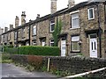
6
Springfield Terrace - Sunfield Place
Image: © Betty Longbottom
Taken: 29 Apr 2018
0.05 miles
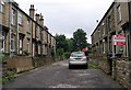
7
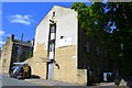
Sunfield Place, Stanningley, Leeds
This was once an Basket Factory
Image: © Mark Stevenson
Taken: 9 Jun 2015
0.05 miles
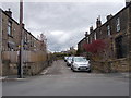
8
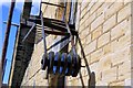
Sunfield Place, Stanningley, Leeds
This was once an Basket Factory
Image: © Mark Stevenson
Taken: 9 Jun 2015
0.05 miles