IMAGES TAKEN NEAR TO
Coney Moor Grove, LEEDS, LS26 9AX
Introduction
This page details the photographs taken nearby to Coney Moor Grove, LS26 9AX by members of the Geograph project.
The Geograph project started in 2005 with the aim of publishing, organising and preserving representative images for every square kilometre of Great Britain, Ireland and the Isle of Man.

There are currently over 7.5m images from over14,400 individuals and you can help contribute to the project by visiting https://www.geograph.org.uk
Image Map (Loading...)


Getting Data...Please wait
Leaflet Map data © OpenStreetMap
Images are licensed for reuse under creativecommons.org/licenses/by-sa/2.0
Notes
- Clicking on the map will re-center to the selected point.
- The higher the marker number, the further away the image location is from the centre of the postcode.
Image Listing (18 Images Found)
Images are licensed for reuse under creativecommons.org/licenses/by-sa/2.0
Image
Details
Distance
1

Wheelie bins on the pavement, Lower Mickletown
Image: © Christine Johnstone
Taken: 20 Nov 2009
0.08 miles
2

Roadside gate, Lower Mickletown
Image: © Christine Johnstone
Taken: 20 Nov 2009
0.08 miles


5

The New Queen.
Pub at Lower Mickletown.
Image: © Steve Partridge
Taken: 10 Apr 2006
0.14 miles

8
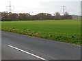
Look, no hedge!
It's unusual in this area to find a roadside field boundary without a hedge or a fence.
Image: © Christine Johnstone
Taken: 20 Nov 2009
0.16 miles
9
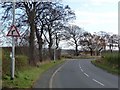
Sharp bend, leaving Lower Mickletown
Image: © Christine Johnstone
Taken: 20 Nov 2009
0.16 miles
10

Sunlit road sign against a stormy sky
Image: © Christine Johnstone
Taken: 20 Nov 2009
0.18 miles