IMAGES TAKEN NEAR TO
Wakefield Road, LEEDS, LS26 8BT
Introduction
This page details the photographs taken nearby to Wakefield Road, LS26 8BT by members of the Geograph project.
The Geograph project started in 2005 with the aim of publishing, organising and preserving representative images for every square kilometre of Great Britain, Ireland and the Isle of Man.

There are currently over 7.5m images from over14,400 individuals and you can help contribute to the project by visiting https://www.geograph.org.uk
Image Map
Images are licensed for reuse under creativecommons.org/licenses/by-sa/2.0
Notes
- Clicking on the map will re-center to the selected point.
- The higher the marker number, the further away the image location is from the centre of the postcode.
Image Listing (20 Images Found)
Images are licensed for reuse under creativecommons.org/licenses/by-sa/2.0
Image
Details
Distance
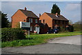
2
Entrance to Forterra site, Wakefield Road, Swillington
Forterra is a brick-making company (Geograph members may remember our visit to their Whittlesea plant some years ago). According to one source (1) it opened in 1966, originally by George Armitage & Sons, later Marshalls, then Hansons, who closed it in 2008. Another source (2) says the buildings were demolished in 2015. Forterra's Twitter feed (3) says they subsequently acquired the clay pit with its 4.5M tonnes of reserves, 'with the option to construct a new brick factory in the future'.
Two of the three houses (brick, naturally!) shown in Image have since been demolished, probably at the same time as the brickworks itself, which can be seen in an older photo Image
(1) https://www.28dayslater.co.uk/threads/swillington-brickworks-jan-11.57378/
(2) https://www.dsrdemolition.co.uk/swillington
(3) https://twitter.com/ForterraUK/status/1534882810716205058
Image: © Stephen Craven
Taken: 19 Mar 2023
0.01 miles
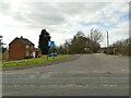
3
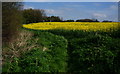
Footpath off Wakefield Road
The path on the outskirts of Swillington takes the Leeds Country Way through a small country park (on the site of former mine workings) towards Whitehouse Lane.
Image: © Stephen Craven
Taken: 19 Mar 2023
0.09 miles
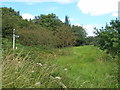
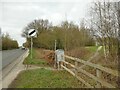
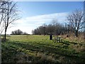
7
Whitehouse Lane picnic area
Part of a small country park near Swillington.
Image: © Stephen Craven
Taken: 19 Mar 2023
0.17 miles
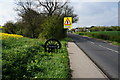
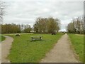
8
Picnic area off Wakefield Road near Swillington
Image: © Ian S
Taken: 23 Apr 2014
0.21 miles
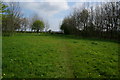
9
Picnic site alongside the Leeds Country Way
Only found because it is marked on my OS Explorer map.
Image: © Christine Johnstone
Taken: 9 Jan 2013
0.21 miles
10
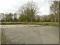
Whitehouse Lane car park
The car park serves a small country park near Swillington.
Image: © Stephen Craven
Taken: 19 Mar 2023
0.22 miles