IMAGES TAKEN NEAR TO
Hemishor Drive, LEEDS, LS26 8BA
Introduction
This page details the photographs taken nearby to Hemishor Drive, LS26 8BA by members of the Geograph project.
The Geograph project started in 2005 with the aim of publishing, organising and preserving representative images for every square kilometre of Great Britain, Ireland and the Isle of Man.

There are currently over 7.5m images from over14,400 individuals and you can help contribute to the project by visiting https://www.geograph.org.uk
Image Map
Images are licensed for reuse under creativecommons.org/licenses/by-sa/2.0
Notes
- Clicking on the map will re-center to the selected point.
- The higher the marker number, the further away the image location is from the centre of the postcode.
Image Listing (44 Images Found)
Images are licensed for reuse under creativecommons.org/licenses/by-sa/2.0
Image
Details
Distance
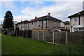
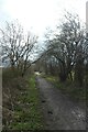
2
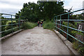
The Lines Way at Great Preston
Route of the former Garforth to Castleford single track railway passing by Great Preston.
Now Cycle Route No 697, and a permissive bridleway.
Image: © Chris Heaton
Taken: 9 May 2021
0.04 miles
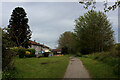
3
Lines Way near Valley Drive
The Lines Way is a cycle path from Garforth to Allerton Bywater along the former railway line. It is designated as part of National Cycle Network route 697.
Image: © DS Pugh
Taken: 18 Mar 2023
0.04 miles
4
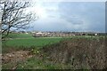
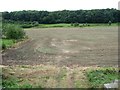
Farmland west of Kippax
Looking across fields towards Kippax from The Lines Way.
Image: © DS Pugh
Taken: 18 Mar 2023
0.08 miles
6
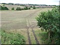
Track across a field, looking towards Kippax
The track passes under the former Garforth - Allerton Bywater railway line, now the Lines Way permissive bridleway.
Image: © Christine Johnstone
Taken: 26 Aug 2012
0.10 miles
7
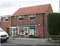
Post Office - St Aidan's Road, Great Preston
Image: © Betty Longbottom
Taken: 27 Mar 2008
0.11 miles
8
Woodland on Preston Hill
Seen from a former railway bridge over a farm track. The railway line is now a permissive bridleway called the Lines Way.
Image: © Christine Johnstone
Taken: 26 Aug 2012
0.11 miles
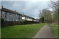
9
Cycle path from Garforth
The Lines Way is a cycle path from Garforth to Allerton Bywater along the former railway line. It is designated as part of National Cycle Network route 697.
Image: © DS Pugh
Taken: 18 Mar 2023
0.12 miles
10
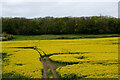
View towards Preston Hill
The small hill is covered in woodland - seen from the Lines Way over a field of rape.
Image: © Chris Heaton
Taken: 9 May 2021
0.12 miles