IMAGES TAKEN NEAR TO
Aintree Close, LEEDS, LS25 7HY
Introduction
This page details the photographs taken nearby to Aintree Close, LS25 7HY by members of the Geograph project.
The Geograph project started in 2005 with the aim of publishing, organising and preserving representative images for every square kilometre of Great Britain, Ireland and the Isle of Man.

There are currently over 7.5m images from over14,400 individuals and you can help contribute to the project by visiting https://www.geograph.org.uk
Image Map (Loading...)


Getting Data...Please wait
Leaflet Map data © OpenStreetMap
Images are licensed for reuse under creativecommons.org/licenses/by-sa/2.0
Notes
- Clicking on the map will re-center to the selected point.
- The higher the marker number, the further away the image location is from the centre of the postcode.
Image Listing (49 Images Found)
Images are licensed for reuse under creativecommons.org/licenses/by-sa/2.0
Image
Details
Distance
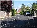
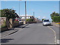
3
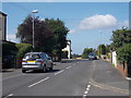
Westfield Lane - viewed from Epsom Road
Image: © Betty Longbottom
Taken: 8 Aug 2016
0.03 miles
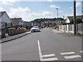
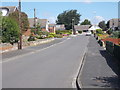
5
Westfield Lane - viewed from Epsom Road
Image: © Betty Longbottom
Taken: 8 Aug 2016
0.05 miles
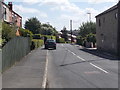
7
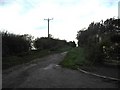
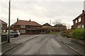
Green Lane Bridleway
Green Lane (Track or Bridleway) on the West side of Kippax leading to Brecks Lane.
Image: © Darren Haddock
Taken: 27 Oct 2006
0.06 miles
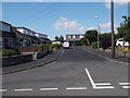
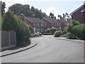
8
Ascot Road - viewed from Goodwood Avenue
Image: © Betty Longbottom
Taken: 8 Aug 2016
0.08 miles