IMAGES TAKEN NEAR TO
Leeds Road, LEEDS, LS25 7EL
Introduction
This page details the photographs taken nearby to Leeds Road, LS25 7EL by members of the Geograph project.
The Geograph project started in 2005 with the aim of publishing, organising and preserving representative images for every square kilometre of Great Britain, Ireland and the Isle of Man.

There are currently over 7.5m images from over14,400 individuals and you can help contribute to the project by visiting https://www.geograph.org.uk
Image Map (Loading...)


Getting Data...Please wait
Leaflet Map data © OpenStreetMap
Images are licensed for reuse under creativecommons.org/licenses/by-sa/2.0
Notes
- Clicking on the map will re-center to the selected point.
- The higher the marker number, the further away the image location is from the centre of the postcode.
Image Listing (48 Images Found)
Images are licensed for reuse under creativecommons.org/licenses/by-sa/2.0
Image
Details
Distance
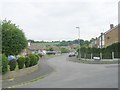
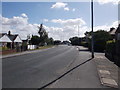
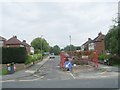
1
Leeds Road - viewed from Valley Road
Image: © Betty Longbottom
Taken: 8 Aug 2016
0.03 miles
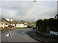
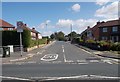
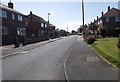
3
Leeds Road - viewed from Valley Road
Image: © Betty Longbottom
Taken: 8 Aug 2016
0.05 miles
4
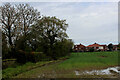
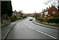
Soggy Field on the Northern Fringe of Kippax
Seen on the bridleway from Garforth.
How long this scene remains intact is anyone's guess, as the former mining community of Kippax is expanding fast - with houses sprouting up in several locations hereabouts.
Image: © Chris Heaton
Taken: 9 May 2021
0.05 miles
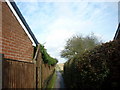
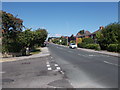
8
Valley Ridge - looking towards Valley Road
Image: © Betty Longbottom
Taken: 8 Aug 2016
0.10 miles