IMAGES TAKEN NEAR TO
Park View, LEEDS, LS25 7AX
Introduction
This page details the photographs taken nearby to Park View, LS25 7AX by members of the Geograph project.
The Geograph project started in 2005 with the aim of publishing, organising and preserving representative images for every square kilometre of Great Britain, Ireland and the Isle of Man.

There are currently over 7.5m images from over14,400 individuals and you can help contribute to the project by visiting https://www.geograph.org.uk
Image Map (125 Images)


Getting Data...Please wait
Leaflet Map data © OpenStreetMap
Images are licensed for reuse under creativecommons.org/licenses/by-sa/2.0
Notes
- Clicking on the map will re-center to the selected point.
- The higher the marker number, the further away the image location is from the centre of the postcode.
Image Listing (125 Images Found)
Images are licensed for reuse under creativecommons.org/licenses/by-sa/2.0
Image
Details
Distance
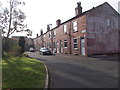
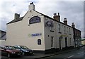
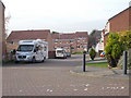
2
The Intake - viewed from Malt Kiln Lane
Image: © Betty Longbottom
Taken: 31 Oct 2016
0.01 miles
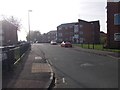
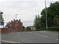
3
Manor Terrace - off Apple Tree Lane
Image: © Betty Longbottom
Taken: 31 Oct 2016
0.02 miles
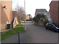
4
Mount Pleasant Gardens - Malt Kiln Lane
Image: © Betty Longbottom
Taken: 31 Oct 2016
0.03 miles
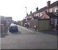
6
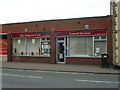
Wm. Dodgson & Son Funeral Directors - High Street
Image: © Betty Longbottom
Taken: 11 Jun 2010
0.03 miles
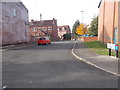
10
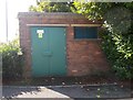
Electricity Substation No 2737 - Apple Tree Lane
Image: © Betty Longbottom
Taken: 26 Aug 2016
0.05 miles