IMAGES TAKEN NEAR TO
Ridge Road, LEEDS, LS25 4DW
Introduction
This page details the photographs taken nearby to Ridge Road, LS25 4DW by members of the Geograph project.
The Geograph project started in 2005 with the aim of publishing, organising and preserving representative images for every square kilometre of Great Britain, Ireland and the Isle of Man.

There are currently over 7.5m images from over14,400 individuals and you can help contribute to the project by visiting https://www.geograph.org.uk
Image Map (Loading...)


Getting Data...Please wait
Leaflet Map data © OpenStreetMap
Images are licensed for reuse under creativecommons.org/licenses/by-sa/2.0
Notes
- Clicking on the map will re-center to the selected point.
- The higher the marker number, the further away the image location is from the centre of the postcode.
Image Listing (27 Images Found)
Images are licensed for reuse under creativecommons.org/licenses/by-sa/2.0
Image
Details
Distance
1
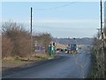
Entrance to Peckfield Quarry
A limestone quarry, with an access road running east from the A656.
Image: © Christine Johnstone
Taken: 11 Dec 2013
0.00 miles
2
Entrance to Peckfield landfill site
This was a stone quarry even six years ago Image, now a landfill site.
Image: © Stephen Craven
Taken: 6 Oct 2019
0.02 miles
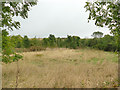
3
Farmland north of Warren House
Seen from Upper Peckfield Lane [a public bridleway].
Image: © Christine Johnstone
Taken: 11 Dec 2013
0.09 miles
4
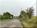
Upper Peckfield Lane and the road to Peckfield Quarry
Signs warn lorry drivers about possible users of the bridleway.
Image: © Christine Johnstone
Taken: 11 Dec 2013
0.10 miles
5
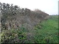
Hedge on the north side of Peckfield Quarry road
Looking west from the public bridleway.
Image: © Christine Johnstone
Taken: 11 Dec 2013
0.11 miles
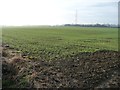
6
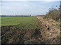
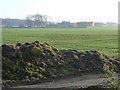
Emerging crop, south of the road to Peckfield Quarry
West of Upper Peckfield Lane [a public bridleway].
Image: © Christine Johnstone
Taken: 11 Dec 2013
0.11 miles
7
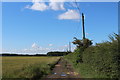
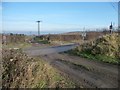
Bridleway heading South towards the A63
The map indicates this track as Pit Lane, although a fingerpost begs to differ - marking it as Upper Peckfield Lane
Image: © Chris Heaton
Taken: 11 Jul 2020
0.12 miles
8
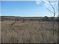
New plantation, north-west of Peckfield Quarry
On the east side of the public bridleway, east of Warren Farm.
Image: © Christine Johnstone
Taken: 11 Dec 2013
0.12 miles
9
Planting around Peckfill landfill site
Possibly part of an environmental compensation scheme.
Image: © Stephen Craven
Taken: 6 Oct 2019
0.13 miles
10
Farmland north-east of Peckfield Bar
West of Upper Peckfield Lane [a public bridleway].
Image: © Christine Johnstone
Taken: 11 Dec 2013
0.15 miles