
IMAGES TAKEN NEAR TO
Widows Row, LEEDS, LS25 3DR
Introduction
This page details the photographs taken nearby to Widows Row, LS25 3DR by members of the Geograph project.
The Geograph project started in 2005 with the aim of publishing, organising and preserving representative images for every square kilometre of Great Britain, Ireland and the Isle of Man.

There are currently over 7.5m images from over14,400 individuals and you can help contribute to the project by visiting https://www.geograph.org.uk
Image Map
Images are licensed for reuse under creativecommons.org/licenses/by-sa/2.0
Notes
- Clicking on the map will re-center to the selected point.
- The higher the marker number, the further away the image location is from the centre of the postcode.
Image Listing (79 Images Found)
Images are licensed for reuse under creativecommons.org/licenses/by-sa/2.0
Image
Details
Distance
1
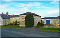
Farm buildings, Whitehouse Farm, Aberford
The buildings attached to the farmhouse have dummy windows as if pretending to be houses.
Image: © Humphrey Bolton
Taken: 2 May 2021
0.03 miles
2
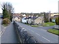
Bunkers Hill, Aberford
Looking north from the raised pavement.
Image: © Christine Johnstone
Taken: 27 Mar 2015
0.03 miles
3
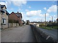
Raised roadway and pavement, Bunkers Hill, Aberford
On the west side of the old Great North Road, the former A1.
Image: © Christine Johnstone
Taken: 27 Mar 2015
0.04 miles
4
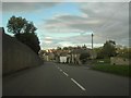
Bunkers Hill, Aberford
View down Bunkers Hill, Aberford with Young's Court on the right.
Image: © Darren Haddock
Taken: 2 Oct 2006
0.05 miles
5
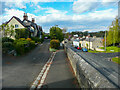
Split level road, Aberford
Where the old Great North Road slopes down to cross the tiny River Crow the footway on the west side stays high. Presumably there was a limestone cliff here long ago but now there is a surprisingly tall retaining wall.
Image: © Humphrey Bolton
Taken: 2 May 2021
0.05 miles
6
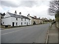
Houses climbing Bunkers Hill, Aberford
The Great North Road, taken at a 41 metre spot height.
Image: © Christine Johnstone
Taken: 27 Mar 2015
0.07 miles
7
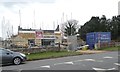
Construction site, Bunkers Hill, Aberford
Stone on the outside, breeze block on the inside.
Image: © Christine Johnstone
Taken: 27 Mar 2015
0.08 miles
8
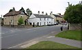
Aberford
Looking to the right, southwards along the old Great North Road, at the junction shown in Image The view looking northwards is at Image
Image: © Derek Harper
Taken: 1 Aug 2011
0.08 miles
9
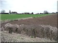
Farmland on the western edge of Aberford
Aberford is a very linear village, strung out for 2 kms along the Great North Road.
Image: © Christine Johnstone
Taken: 27 Mar 2015
0.09 miles
10
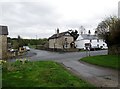
Crossroads in Aberford
The main road through Aberford once the Great North Road is now just local traffic, the present A1(M) roars past a few hundred yards down the road opposite, Lotherton Lane
Image: © Martin Dawes
Taken: 29 Mar 2017
0.09 miles