IMAGES TAKEN NEAR TO
Shaw Close, LEEDS, LS25 2HA
Introduction
This page details the photographs taken nearby to Shaw Close, LS25 2HA by members of the Geograph project.
The Geograph project started in 2005 with the aim of publishing, organising and preserving representative images for every square kilometre of Great Britain, Ireland and the Isle of Man.

There are currently over 7.5m images from over14,400 individuals and you can help contribute to the project by visiting https://www.geograph.org.uk
Image Map (Loading...)


Getting Data...Please wait
Leaflet Map data © OpenStreetMap
Images are licensed for reuse under creativecommons.org/licenses/by-sa/2.0
Notes
- Clicking on the map will re-center to the selected point.
- The higher the marker number, the further away the image location is from the centre of the postcode.
Image Listing (56 Images Found)
Images are licensed for reuse under creativecommons.org/licenses/by-sa/2.0
Image
Details
Distance
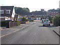
1
Cliffe House Avenue - viewed from Kirkby Avenue
Image: © Betty Longbottom
Taken: 13 Sep 2016
0.04 miles
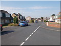
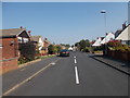
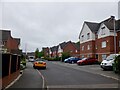
2
Shaw Close - looking towards Ninelands Lane
Image: © Betty Longbottom
Taken: 13 Sep 2016
0.05 miles
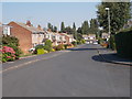
4
Cliffe House Avenue - Ledston Avenue
Image: © Betty Longbottom
Taken: 13 Sep 2016
0.05 miles
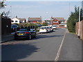
5
Kirkby Avenue - Cliffe House Avenue
Image: © Betty Longbottom
Taken: 13 Sep 2016
0.05 miles
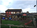
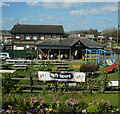
8
Bluebell Avenue
A new bit of Garforth.
Image: © Richard Webb
Taken: 30 May 2023
0.08 miles
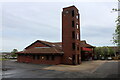
9

Old Milestone by the A63, Selby Road, Garforth parish
Metal plate attached to stone post by the A63, in parish of GARFORTH (LEEDS District), Selby Road, at East end of Garforth, junction with Ninelands Lane, under hedge, at traffic lights, on South side of road. TP iron casting, erected by the County Council in the 19th/20th century.
Inscription reads:-
: LEEDS / 7 / MILES : : SELBY AND LEEDS / TURNPIKE ROAD : : SELBY / 13 / MILES :
Rivet in top.
Grade II listed.
List Entry Number: 1264131 https://historicengland.org.uk/listing/the-list/list-entry/1264131
Milestone Society National ID: YW_SYLE13.
Image: © C Minto
Taken: 1 Mar 2002
0.08 miles