IMAGES TAKEN NEAR TO
Ellis Lane, LEEDS, LS25 2DP
Introduction
This page details the photographs taken nearby to Ellis Lane, LS25 2DP by members of the Geograph project.
The Geograph project started in 2005 with the aim of publishing, organising and preserving representative images for every square kilometre of Great Britain, Ireland and the Isle of Man.

There are currently over 7.5m images from over14,400 individuals and you can help contribute to the project by visiting https://www.geograph.org.uk
Image Map (Loading...)


Getting Data...Please wait
Leaflet Map data © OpenStreetMap
Images are licensed for reuse under creativecommons.org/licenses/by-sa/2.0
Notes
- Clicking on the map will re-center to the selected point.
- The higher the marker number, the further away the image location is from the centre of the postcode.
Image Listing (5 Images Found)
Images are licensed for reuse under creativecommons.org/licenses/by-sa/2.0
Image
Details
Distance
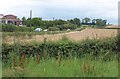
2
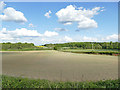
Dry farmland east of Long Lane
There had been little rain since early March.
Image: © Stephen Craven
Taken: 8 May 2020
0.16 miles
4
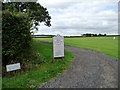
Permissive path, Garforth Golf Club
The public footpath runs on the other side of the hedge, but walkers are encouraged to use this alternative and thus not disturb play.
Image: © Christine Johnstone
Taken: 29 Aug 2011
0.24 miles
5
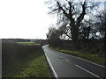
Long Lane
A view of the road between Garforth and Barwick in Elmet from Parlington Lane across a field of wheat. On the left is Image
Image: © Derek Harper
Taken: 1 Aug 2011
0.25 miles