IMAGES TAKEN NEAR TO
Kentmere Avenue, LEEDS, LS25 2BA
Introduction
This page details the photographs taken nearby to Kentmere Avenue, LS25 2BA by members of the Geograph project.
The Geograph project started in 2005 with the aim of publishing, organising and preserving representative images for every square kilometre of Great Britain, Ireland and the Isle of Man.

There are currently over 7.5m images from over14,400 individuals and you can help contribute to the project by visiting https://www.geograph.org.uk
Image Map
Images are licensed for reuse under creativecommons.org/licenses/by-sa/2.0
Notes
- Clicking on the map will re-center to the selected point.
- The higher the marker number, the further away the image location is from the centre of the postcode.
Image Listing (39 Images Found)
Images are licensed for reuse under creativecommons.org/licenses/by-sa/2.0
Image
Details
Distance
5
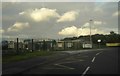
Green Lane Infant & Junior School
View of entrance to school which is currently undergoing building works.
Image: © Darren Haddock
Taken: 2 Oct 2006
0.05 miles
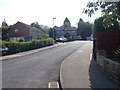
6
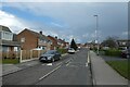
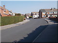
Fairburn Drive / Kentmere Avenue bus stops
Looking along Fairburn Drive, a residential street in Garforth.
Image: © DS Pugh
Taken: 18 Mar 2023
0.06 miles
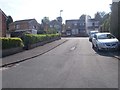
7
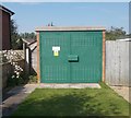
Electricity Substation No 3714 - Fairburn Drive
Image: © Betty Longbottom
Taken: 13 Sep 2016
0.06 miles
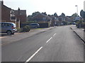
8
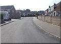
Swale Crescent - Ribblesdale Avenue
Image: © Betty Longbottom
Taken: 13 Sep 2016
0.07 miles
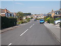
10
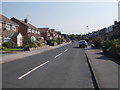
Ribblesdale Avenue - Fairburn Drive
Image: © Betty Longbottom
Taken: 13 Sep 2016
0.07 miles