
IMAGES TAKEN NEAR TO
Wakefield Road, LEEDS, LS25 1NE
Introduction
This page details the photographs taken nearby to Wakefield Road, LS25 1NE by members of the Geograph project.
The Geograph project started in 2005 with the aim of publishing, organising and preserving representative images for every square kilometre of Great Britain, Ireland and the Isle of Man.

There are currently over 7.5m images from over14,400 individuals and you can help contribute to the project by visiting https://www.geograph.org.uk
Image Map
Images are licensed for reuse under creativecommons.org/licenses/by-sa/2.0
Notes
- Clicking on the map will re-center to the selected point.
- The higher the marker number, the further away the image location is from the centre of the postcode.
Image Listing (40 Images Found)
Images are licensed for reuse under creativecommons.org/licenses/by-sa/2.0
Image
Details
Distance
6
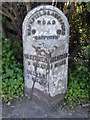
Old milestone
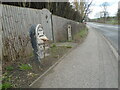
A view southwards towards the A63 through Garforth. Now that the hedge has been replaced by a fence the milestone is more obvious. When erected, the backing stone for this type of milestone was not painted. Over the years some have been painted black or white. There is a hole in the top of this stone which may be an OS benchmark position.
Image: © Chris Minto
Taken: 5 Mar 2023
0.08 miles
7
Old milestone
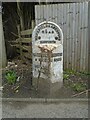
Another of the West Riding CC milestones dating from 1893/94 with the metal part cast at the Brayshaw & Booth foundry in Liversedge. This used to have a hedge behind it but now a tall wooden fence surrounding a house. Although Grade II listed 1237403 it is very neglected. Fortunately the crack on the left face hasn't worsened. It is Grade II listed 1237403.
Image: © Chris Minto
Taken: 5 Mar 2023
0.08 miles
8
Old Milestone, A642, Aberford Road
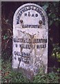
N of A63 near Manor Lodge. Located on the East side of road, in hedge bottom. Metal plate attached to stone post, Brayshaw & Booth casting design, 19th century. Alternative view see http://www.geograph.org.uk/photo/4943702
Inscription reads: WAKEFIELD / 9 MILES / OULTON / 4 MILES // ABERFORD / 4 MILES // WAKEFIELD & ABERFORD / ROAD / GARFORTH // BRAYSHAW & BOOTH / MAKERS / LIVERSEDGE
Grade II listed by Historic England. see https://historicengland.org.uk/listing/the-list/list-entry/1237403
Milestone Society National ID: YW_WKAF09
Image: © Christine Minto
Taken: 4 Feb 2006
0.08 miles
10
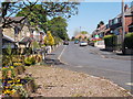
Westbourne Terrace - looking towards Westbourne Grove
Image: © Betty Longbottom
Taken: 9 May 2016
0.09 miles