IMAGES TAKEN NEAR TO
Springfield Place, LEEDS, LS25 1LT
Introduction
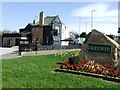
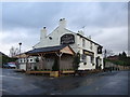
This page details the photographs taken nearby to Springfield Place, LS25 1LT by members of the Geograph project.
The Geograph project started in 2005 with the aim of publishing, organising and preserving representative images for every square kilometre of Great Britain, Ireland and the Isle of Man.

There are currently over 7.5m images from over14,400 individuals and you can help contribute to the project by visiting https://www.geograph.org.uk
Image Map (Loading...)


Getting Data...Please wait
Leaflet Map data © OpenStreetMap
Images are licensed for reuse under creativecommons.org/licenses/by-sa/2.0
Notes
- Clicking on the map will re-center to the selected point.
- The higher the marker number, the further away the image location is from the centre of the postcode.
Image Listing (62 Images Found)
Images are licensed for reuse under creativecommons.org/licenses/by-sa/2.0
Image
Details
Distance
5
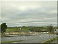
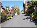
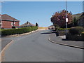
Entrance to new housing estate off Selby Road
The estate will be called 'Silverwood'.
Image: © Stephen Craven
Taken: 22 Jan 2022
0.10 miles
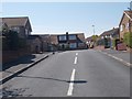
8
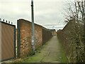
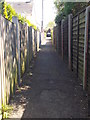
Footpath from Westbourne Avenue to Selby Road
Part of a historic right of way as shown on older maps.
Image: © Stephen Craven
Taken: 22 Jan 2022
0.10 miles