IMAGES TAKEN NEAR TO
Church Place, LEEDS, LS25 1JE
Introduction
This page details the photographs taken nearby to Church Place, LS25 1JE by members of the Geograph project.
The Geograph project started in 2005 with the aim of publishing, organising and preserving representative images for every square kilometre of Great Britain, Ireland and the Isle of Man.

There are currently over 7.5m images from over14,400 individuals and you can help contribute to the project by visiting https://www.geograph.org.uk
Image Map
Images are licensed for reuse under creativecommons.org/licenses/by-sa/2.0
Notes
- Clicking on the map will re-center to the selected point.
- The higher the marker number, the further away the image location is from the centre of the postcode.
Image Listing (147 Images Found)
Images are licensed for reuse under creativecommons.org/licenses/by-sa/2.0
Image
Details
Distance
1
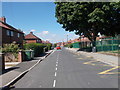
Traffic calming measures on Station Fields
Looking along Station Fields in Garforth with a barrier preventing through use.
Image: © DS Pugh
Taken: 18 Mar 2023
0.03 miles
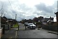
2
Barrier on Station Fields, Garforth
This would have been a through road from Church Lane to the railway station, but this barrier now prevents through motor traffic while permitting pedestrians and cyclists to pass.
Image: © Stephen Craven
Taken: 22 Jan 2022
0.03 miles
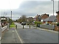
4
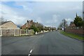
Station Fields towards Garforth Station
Looking along a residential street in Garforth. Behind the camera is a barrier preventing through traffic.
Image: © DS Pugh
Taken: 18 Mar 2023
0.05 miles
5
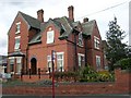
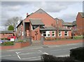
The Hollies Residential Home for the Elderly - Church Lane
Image: © Betty Longbottom
Taken: 19 Mar 2008
0.06 miles
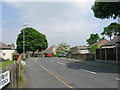
7
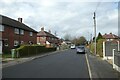
Church Lane in Garforth
On the left is Church Approach.
Image: © DS Pugh
Taken: 18 Mar 2023
0.06 miles
8
St Armand's Court Residential Home for the Elderly - Church Lane
Image: © Betty Longbottom
Taken: 19 Mar 2008
0.08 miles
9
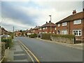
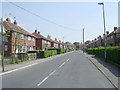
Oak Crescent, Garforth
The 'Crescent' is laid out, not as a smooth curve, but as a series of four straight sections. The single yellow lines indicate a parking restriction which applies from 10am to 2pm; probably intended to deter commuters from parking here for the nearby railway station.
Image: © Stephen Craven
Taken: 22 Jan 2022
0.08 miles