IMAGES TAKEN NEAR TO
Nursery Way, WETHERBY, LS23 6PS
Introduction
This page details the photographs taken nearby to Nursery Way, LS23 6PS by members of the Geograph project.
The Geograph project started in 2005 with the aim of publishing, organising and preserving representative images for every square kilometre of Great Britain, Ireland and the Isle of Man.

There are currently over 7.5m images from over14,400 individuals and you can help contribute to the project by visiting https://www.geograph.org.uk
Image Map (Loading...)


Getting Data...Please wait
Leaflet Map data © OpenStreetMap
Images are licensed for reuse under creativecommons.org/licenses/by-sa/2.0
Notes
- Clicking on the map will re-center to the selected point.
- The higher the marker number, the further away the image location is from the centre of the postcode.
Image Listing (48 Images Found)
Images are licensed for reuse under creativecommons.org/licenses/by-sa/2.0
Image
Details
Distance
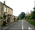
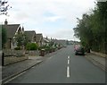
1
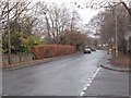
High Street - viewed from Clifford Moor Road
Image: © Betty Longbottom
Taken: 7 Dec 2016
0.02 miles

4
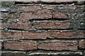
Horizontally bedded limestone in a wall in High Street, Boston Spa
Image: © Chris
Taken: 29 Nov 2018
0.04 miles
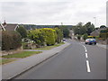
5
Moor End - viewed from Clifford Moor Road
Image: © Betty Longbottom
Taken: 7 Dec 2016
0.05 miles
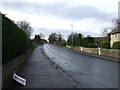
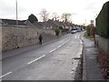
9
Clifford Moor Road - viewed from Heathfield Lane
Image: © Betty Longbottom
Taken: 19 Aug 2016
0.07 miles
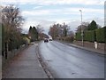
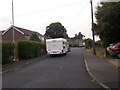
10
Heathfield Lane - Clifford Moor Road, Boston Spa
Image: © Betty Longbottom
Taken: 10 Sep 2008
0.07 miles