IMAGES TAKEN NEAR TO
Toulston Lane, WETHERBY, LS23 6LJ
Introduction
This page details the photographs taken nearby to Toulston Lane, LS23 6LJ by members of the Geograph project.
The Geograph project started in 2005 with the aim of publishing, organising and preserving representative images for every square kilometre of Great Britain, Ireland and the Isle of Man.

There are currently over 7.5m images from over14,400 individuals and you can help contribute to the project by visiting https://www.geograph.org.uk
Image Map (Loading...)


Getting Data...Please wait
Leaflet Map data © OpenStreetMap
Images are licensed for reuse under creativecommons.org/licenses/by-sa/2.0
Notes
- Clicking on the map will re-center to the selected point.
- The higher the marker number, the further away the image location is from the centre of the postcode.
Image Listing (15 Images Found)
Images are licensed for reuse under creativecommons.org/licenses/by-sa/2.0
Image
Details
Distance
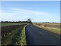
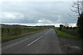
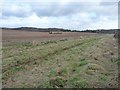
1
Passing New York Farm
Looking towards Bramham along Toulston Lane from Tadcaster.
Image: © DS Pugh
Taken: 18 Mar 2023
0.00 miles
2
New York Farm
Thorner Lane heading towards Bramham.
Image: © DS Pugh
Taken: 3 Aug 2024
0.01 miles
3
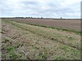
Permissive access bridle path heading west
Running parallel to the north side of Toulston Lane. It was created by the Bramham estate and funded by DEFRA's Countryside Stewardship Scheme.
Image: © Christine Johnstone
Taken: 6 Feb 2013
0.06 miles
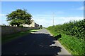
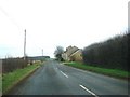
4
Toulston Lane near New York Farm
Looking towards Tadcaster along the road from Bramham.
Image: © DS Pugh
Taken: 18 Mar 2023
0.06 miles
5
Public footpath to Headley Lane
Running south from Toulston Lane, alongside New York Farm.
Image: © Christine Johnstone
Taken: 6 Feb 2013
0.06 miles
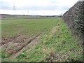
7
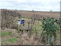
Entrance to the permissive access bridle path
Running parallel to the north side of Toulston Lane. The blue notice says that it was created by the Bramham estate and funded by DEFRA's Countryside Stewardship Scheme.
Image: © Christine Johnstone
Taken: 6 Feb 2013
0.08 miles
8
Permissive access bridle path heading east
Running parallel to the north side of Toulston Lane. It was created by the Bramham estate and funded by DEFRA's Countryside Stewardship Scheme.
Image: © Christine Johnstone
Taken: 6 Feb 2013
0.10 miles
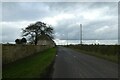
9
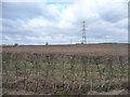
Power lines crossing farmland, near New York Farm
On the north side of Toulston Lane.
Image: © Christine Johnstone
Taken: 6 Feb 2013
0.12 miles