IMAGES TAKEN NEAR TO
Hunters Walk, WETHERBY, LS22 7XX
Introduction
This page details the photographs taken nearby to Hunters Walk, LS22 7XX by members of the Geograph project.
The Geograph project started in 2005 with the aim of publishing, organising and preserving representative images for every square kilometre of Great Britain, Ireland and the Isle of Man.

There are currently over 7.5m images from over14,400 individuals and you can help contribute to the project by visiting https://www.geograph.org.uk
Image Map
Images are licensed for reuse under creativecommons.org/licenses/by-sa/2.0
Notes
- Clicking on the map will re-center to the selected point.
- The higher the marker number, the further away the image location is from the centre of the postcode.
Image Listing (78 Images Found)
Images are licensed for reuse under creativecommons.org/licenses/by-sa/2.0
Image
Details
Distance
1
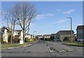
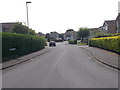
Hunters Walk - looking towards Badger Wood Glade
Image: © Betty Longbottom
Taken: 20 Jul 2016
0.02 miles
4
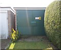
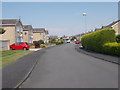
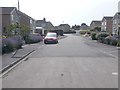
Electricity Substation No 4708 - Foxwood Walk
Image: © Betty Longbottom
Taken: 20 Jul 2016
0.05 miles
5
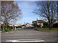
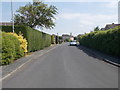
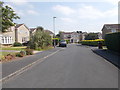
Deerstone Ridge, Deighton Gates
A different angle on the junction shown in Image, seen across the B6164 Deighton Road.
Image: © Derek Harper
Taken: 6 Apr 2015
0.05 miles