IMAGES TAKEN NEAR TO
Bridle Way, WETHERBY, LS22 6AT
Introduction
This page details the photographs taken nearby to Bridle Way, LS22 6AT by members of the Geograph project.
The Geograph project started in 2005 with the aim of publishing, organising and preserving representative images for every square kilometre of Great Britain, Ireland and the Isle of Man.

There are currently over 7.5m images from over14,400 individuals and you can help contribute to the project by visiting https://www.geograph.org.uk
Image Map (35 Images)


Getting Data...Please wait
Leaflet Map data © OpenStreetMap
Images are licensed for reuse under creativecommons.org/licenses/by-sa/2.0
Notes
- Clicking on the map will re-center to the selected point.
- The higher the marker number, the further away the image location is from the centre of the postcode.
Image Listing (35 Images Found)
Images are licensed for reuse under creativecommons.org/licenses/by-sa/2.0
Image
Details
Distance
3
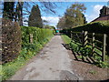
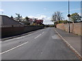
Spofforth Hill - viewed from Chatsworth Drive
Image: © Betty Longbottom
Taken: 3 May 2016
0.10 miles
6
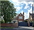
Wetherby, 23 Spofforth Hill
According to the OS benchmark database there is a benchmark cut into the north facing wall. This is a gated property and nothing could be viewed.
Image: © Mel Towler
Taken: 7 Sep 2022
0.13 miles
7
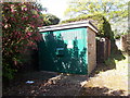
Electricity Substation No 4270 - Chatsworth Drive
Image: © Betty Longbottom
Taken: 3 May 2016
0.13 miles
8
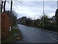
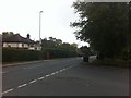
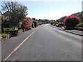
Spofforth Hill (A661), Wetherby
Heading north west.
Image: © JThomas
Taken: 7 Dec 2013
0.13 miles
10
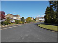
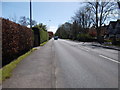
Carlton Approach - viewed from Burnham Court
Image: © Betty Longbottom
Taken: 3 May 2016
0.16 miles