IMAGES TAKEN NEAR TO
Hawthorn Grove, WETHERBY, LS22 5FA
Introduction
This page details the photographs taken nearby to Hawthorn Grove, LS22 5FA by members of the Geograph project.
The Geograph project started in 2005 with the aim of publishing, organising and preserving representative images for every square kilometre of Great Britain, Ireland and the Isle of Man.

There are currently over 7.5m images from over14,400 individuals and you can help contribute to the project by visiting https://www.geograph.org.uk
Image Map
Images are licensed for reuse under creativecommons.org/licenses/by-sa/2.0
Notes
- Clicking on the map will re-center to the selected point.
- The higher the marker number, the further away the image location is from the centre of the postcode.
Image Listing (32 Images Found)
Images are licensed for reuse under creativecommons.org/licenses/by-sa/2.0
Image
Details
Distance
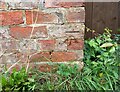
1
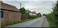
Hunsingore, roadside barn
The barn is on the south side of Moor Lane, and the benchmark is cut into the farthest right bricks, adjacent to a wooden fence.
Image: © Mel Towler
Taken: 16 Oct 2021
0.03 miles
2
Hunsingore, roadside barn
The barn is on the south side of Moor Lane, and the benchmark is cut into the farthest right bricks, adjacent to a wooden fence.
Image: © Mel Towler
Taken: 16 Oct 2021
0.03 miles
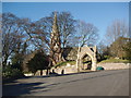
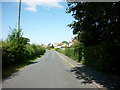
3

Junction at Hunsingore
The right turn leads into the centre of the small village, and to the Church of St John the Baptist http://list.historicengland.org.uk/resultsingle.aspx?uid=1149974&searchtype=mapsearch .
Image: © Derek Harper
Taken: 6 Apr 2015
0.05 miles
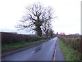
4
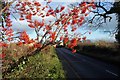
Rowan berries by Moor Lane
Approaching Hunsingore.
Image: © Jonathan Billinger
Taken: 6 Dec 2006
0.06 miles
6
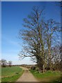
Track, Hunsingore
The track, used by footpath 15 60/2/1, continues the line of Back Lane. Seen here from Ox Moor Lane, it is heading for Northlands Farm and the Great North Road.
Image: © Derek Harper
Taken: 6 Apr 2015
0.11 miles
7
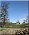
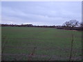
Farmland at Hunsingore
From Ox Moor Lane, looking across a track followed by footpath 15 60/2/1. The wood is Pessac Plantation.
Image: © Derek Harper
Taken: 6 Apr 2015
0.12 miles