IMAGES TAKEN NEAR TO
Wharfe Rein, WETHERBY, LS22 5DP
Introduction
This page details the photographs taken nearby to Wharfe Rein, LS22 5DP by members of the Geograph project.
The Geograph project started in 2005 with the aim of publishing, organising and preserving representative images for every square kilometre of Great Britain, Ireland and the Isle of Man.

There are currently over 7.5m images from over14,400 individuals and you can help contribute to the project by visiting https://www.geograph.org.uk
Image Map
Images are licensed for reuse under creativecommons.org/licenses/by-sa/2.0
Notes
- Clicking on the map will re-center to the selected point.
- The higher the marker number, the further away the image location is from the centre of the postcode.
Image Listing (24 Images Found)
Images are licensed for reuse under creativecommons.org/licenses/by-sa/2.0
Image
Details
Distance
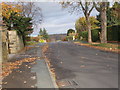
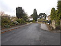
1
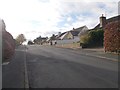
Hill Crest - looking towards Harewood Road
Image: © Betty Longbottom
Taken: 10 Nov 2015
0.05 miles
2
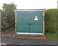
Electricity Substation No 2625 - Wharfe Bank
Image: © Betty Longbottom
Taken: 10 Nov 2015
0.05 miles
3
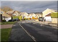
Wharfe Bank - viewed from Hill Crest
Image: © Betty Longbottom
Taken: 10 Nov 2015
0.06 miles
6
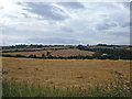
View from the A659 towards Rigton Hill
The valley in the middle distance belongs to Collingham Beck, a tributary of the River Wharfe. The Leeds to Wetherby railway line (now dismantled) followed the valley here. The shot is taken from the western end of Collingham's built up area.
Image: © michael ely
Taken: 1 Aug 2006
0.09 miles
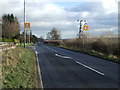
7
Upper Langwith, LS22
Looking north from the street's junction with the A659 (Harewood Road). This street as at the western edge of Collingham and drops down to the River Wharfe. The A659 here is on a ridge between the Wharfe and Collingham Beck.
Image: © michael ely
Taken: 1 Aug 2006
0.09 miles
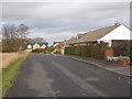
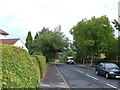
10
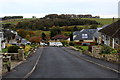
Hillcrest, Collingham
Residential area in the village of Collingham
Image: © Chris Heaton
Taken: 1 Nov 2016
0.13 miles