IMAGES TAKEN NEAR TO
Harewood Road, WETHERBY, LS22 5DL
Introduction
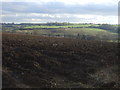
This page details the photographs taken nearby to Harewood Road, LS22 5DL by members of the Geograph project.
The Geograph project started in 2005 with the aim of publishing, organising and preserving representative images for every square kilometre of Great Britain, Ireland and the Isle of Man.

There are currently over 7.5m images from over14,400 individuals and you can help contribute to the project by visiting https://www.geograph.org.uk
Image Map (Loading...)


Getting Data...Please wait
Leaflet Map data © OpenStreetMap
Images are licensed for reuse under creativecommons.org/licenses/by-sa/2.0
Notes
- Clicking on the map will re-center to the selected point.
- The higher the marker number, the further away the image location is from the centre of the postcode.
Image Listing (28 Images Found)
Images are licensed for reuse under creativecommons.org/licenses/by-sa/2.0
Image
Details
Distance
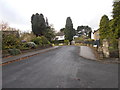
1
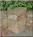
Old Boundary Marker by the A659, Harewood Road, East Keswick parish
Parish Boundary Marker by the A659, on the boundary of East Keswick and Collingham parishes (Leeds District), Harewood Road, against garden wall, North side of road.
Inscriptions are: East Keswick plate missing on the left side and COLLING / HAM on the right side.
Surveyed
Milestone Society National ID: YW_EKECOL01pb
Image: © A Riley
Taken: 29 May 2018
0.01 miles
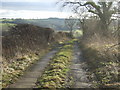
3
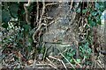
Collingham, Harewood Road
The benchmark is cut into an old gatepost which is not being used, on the south side of Harewood Road.
Image: © Mel Towler
Taken: 25 Sep 2022
0.05 miles
4
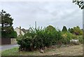
Collingham, Harewood Road
There is a benchmark cut into an old gatepost which is not being used, on the south side of Harewood Road. The gatepost is hidden in this thick roadside hedge.
Image: © Mel Towler
Taken: 25 Sep 2022
0.05 miles
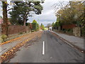
8
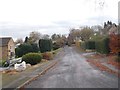
Upper Langwith - viewed from Langwith Drive
Image: © Betty Longbottom
Taken: 10 Nov 2015
0.07 miles
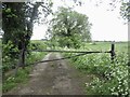
10
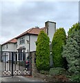
Collingham, Hillbrow
According to the OS benchmark database there is a cutmark on the south face of the property. The property is gated and no search was made.
Image: © Mel Towler
Taken: 25 Sep 2022
0.07 miles