
IMAGES TAKEN NEAR TO
West Busk Lane, OTLEY, LS21 3NG
Introduction
This page details the photographs taken nearby to West Busk Lane, LS21 3NG by members of the Geograph project.
The Geograph project started in 2005 with the aim of publishing, organising and preserving representative images for every square kilometre of Great Britain, Ireland and the Isle of Man.

There are currently over 7.5m images from over14,400 individuals and you can help contribute to the project by visiting https://www.geograph.org.uk
Image Map
Images are licensed for reuse under creativecommons.org/licenses/by-sa/2.0
Notes
- Clicking on the map will re-center to the selected point.
- The higher the marker number, the further away the image location is from the centre of the postcode.
Image Listing (14 Images Found)
Images are licensed for reuse under creativecommons.org/licenses/by-sa/2.0
Image
Details
Distance
1
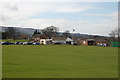
Otley Golf Club House
On the west side of Otley, West Yorkshire
Image: © John Sparshatt
Taken: 4 Apr 2008
0.03 miles
2
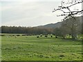
Cattle on Far Close
The field name is as shown on Open Street Map.
Image: © Stephen Craven
Taken: 22 Nov 2020
0.15 miles
3
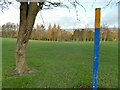
Marked footpath across Otley golf course
A series of yellow-topped post marks the public right of way across the course, which was out of use due to a Covid-19 lockdown.
Image: © Stephen Craven
Taken: 22 Nov 2020
0.18 miles
4
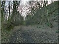
Old railway cutting in Milner Woods
The line ran from Bramhope on the Leeds-Harrogate line, to Ilkley via Otley. It closed to passengers in 1965. This section is walkable, though not a right of way or official permissive path as far as I can tell. Compare Image taken 15 years earlier.
Image: © Stephen Craven
Taken: 22 Nov 2020
0.20 miles
5
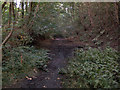
Former Ilkley-Otley railway line
This is the trackbed of the former Otley & Ilkley Railway (Midland and N.E.R. Joint), closed in 1965, viewed eastwards (the Otley direction).
Image: © David Spencer
Taken: 4 Sep 2005
0.21 miles
6
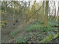
Old railway embankment in Milner Woods
The line ran from Bramhope on the Leeds-Harrogate line, to Ilkley via Otley. It closed to passengers in 1965. It crossed a minor stream at this point. This section is walkable, though not a right of way or official permissive path as far as I can tell.
Image: © Stephen Craven
Taken: 22 Nov 2020
0.22 miles
7
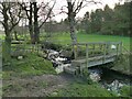
Footpath across a beck on Otley golf course
The beck marks the northern boundary of the golf course.
Image: © Stephen Craven
Taken: 22 Nov 2020
0.22 miles
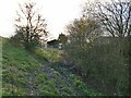
9
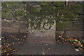
Old Boundary Marker by the A6038, Bradford Road, Menston parish
Parish Boundary Marker by the A6038, in parish of Menston (Bradford District), Bradford Road, Ellar Ghyll, against stone wall.
Inscription reads:-
M O
(Menston and Otley)
To be surveyed
Milestone Society National ID: YW_MENS01pb
Image: © Milestone Society
Taken: Unknown
0.24 miles
10
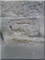
Ordnance Survey Cut Mark
This mark can be found on the wall of a house at Ellar Ghyl.
For more detail see : http://www.bench-marks.org.uk/bm48513
Image: © Peter Wood
Taken: 11 May 2013
0.24 miles