IMAGES TAKEN NEAR TO
Westbourne Close, OTLEY, LS21 3LG
Introduction
This page details the photographs taken nearby to Westbourne Close, LS21 3LG by members of the Geograph project.
The Geograph project started in 2005 with the aim of publishing, organising and preserving representative images for every square kilometre of Great Britain, Ireland and the Isle of Man.

There are currently over 7.5m images from over14,400 individuals and you can help contribute to the project by visiting https://www.geograph.org.uk
Image Map (Loading...)


Getting Data...Please wait
Leaflet Map data © OpenStreetMap
Images are licensed for reuse under creativecommons.org/licenses/by-sa/2.0
Notes
- Clicking on the map will re-center to the selected point.
- The higher the marker number, the further away the image location is from the centre of the postcode.
Image Listing (102 Images Found)
Images are licensed for reuse under creativecommons.org/licenses/by-sa/2.0
Image
Details
Distance
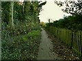
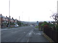
1
Westbourne Close - looking towards Bradford Road
Image: © Betty Longbottom
Taken: 2 Sep 2013
0.03 miles
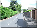
3
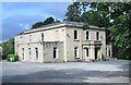
Westbourne House - Westbourne Close
Image: © Betty Longbottom
Taken: 2 Sep 2013
0.05 miles
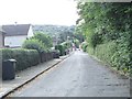
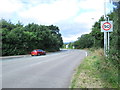
4
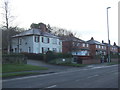
Bradford Road (A6038), Otley
Looking south west.
Image: © JThomas
Taken: 17 Dec 2016
0.05 miles
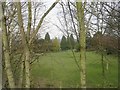
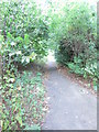
9
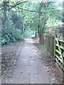
Track off Footpath - end of West Busk Lane
Image: © Betty Longbottom
Taken: 2 Sep 2013
0.07 miles