IMAGES TAKEN NEAR TO
Springfield Road, LEEDS, LS20 9FF
Introduction
This page details the photographs taken nearby to Springfield Road, LS20 9FF by members of the Geograph project.
The Geograph project started in 2005 with the aim of publishing, organising and preserving representative images for every square kilometre of Great Britain, Ireland and the Isle of Man.

There are currently over 7.5m images from over14,400 individuals and you can help contribute to the project by visiting https://www.geograph.org.uk
Image Map (Loading...)


Getting Data...Please wait
Leaflet Map data © OpenStreetMap
Images are licensed for reuse under creativecommons.org/licenses/by-sa/2.0
Notes
- Clicking on the map will re-center to the selected point.
- The higher the marker number, the further away the image location is from the centre of the postcode.
Image Listing (406 Images Found)
Images are licensed for reuse under creativecommons.org/licenses/by-sa/2.0
Image
Details
Distance
2
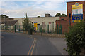
Springhead Business Park
Industrial units to let.
Image: © Mark Anderson
Taken: 23 Jul 2012
0.02 miles
3
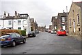
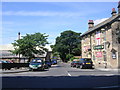
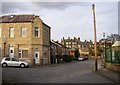
Town Gate, Guiseley
The old town centre, though really more like a village, with the lychgate of the church, and four pubs (one disused).
Image: © Humphrey Bolton
Taken: 15 Feb 2007
0.02 miles
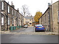
8
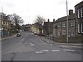
Butts Lane, Guiseley
One of the old lanes of Guiseley, with fields each side in 1851.
Image: © Humphrey Bolton
Taken: 15 Feb 2007
0.04 miles
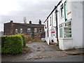
9
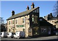
Well Lane, Guiseley
The building on the corner is dated 1892. It has an old street name-plate with 'Well Road', whereas the one on the opposite side of the road has 'Wells Road'. Spring Head Mill is on the right and the well is at the bend in the road, straight ahead.
Image: © Humphrey Bolton
Taken: 15 Feb 2007
0.04 miles
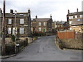
10
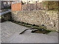
The well, Well Lane, Guiseley
The plaque states that it was restored in 1972, and I suspect that the carved stone is of that date rather than of the 19C as it has Germanic or Scandinavian rather than Classical motifs.
Image: © Humphrey Bolton
Taken: 15 Feb 2007
0.04 miles