
IMAGES TAKEN NEAR TO
Edison Way, LEEDS, LS20 9FA
Introduction
This page details the photographs taken nearby to Edison Way, LS20 9FA by members of the Geograph project.
The Geograph project started in 2005 with the aim of publishing, organising and preserving representative images for every square kilometre of Great Britain, Ireland and the Isle of Man.

There are currently over 7.5m images from over14,400 individuals and you can help contribute to the project by visiting https://www.geograph.org.uk
Image Map
Images are licensed for reuse under creativecommons.org/licenses/by-sa/2.0
Notes
- Clicking on the map will re-center to the selected point.
- The higher the marker number, the further away the image location is from the centre of the postcode.
Image Listing (122 Images Found)
Images are licensed for reuse under creativecommons.org/licenses/by-sa/2.0
Image
Details
Distance
1
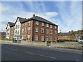
Apartment block on Netherfield Road, Guiseley
The housing is part of a recent development on the site of the former Crompton Parkinson engineering works Image
Image: © Stephen Craven
Taken: 12 Sep 2020
0.01 miles
2
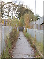
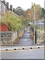
Footpath to Footbridge - Netherfield Road
Image: © Betty Longbottom
Taken: 2 Nov 2012
0.02 miles
3
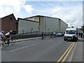
Netherfield Mills, Guiseley
The company (Abraham Moon) was founded in 1837 and still producing woollen textiles, but the building seen here is in fact relatively modern.
Image: © Stephen Craven
Taken: 12 Sep 2020
0.03 miles
4
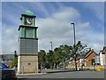
Guiseley clock tower
The copper-domed clock was part of the nearby Crompton Parkinson factory, which has been demolished Image and replaced by housing. It now stands isolated on top of a modern tower in a car park on a different site.
Image: © Stephen Craven
Taken: 12 Sep 2020
0.04 miles
5
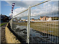
Early stages on the Redevelopment of the Parkinson's factory site by Bellway Homes
The Show Home is open and a lot of cleared open space for a brownfield development.
Image: © Julian Paren
Taken: 9 Nov 2009
0.04 miles
7
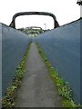
Ings Crescent railway footbridge - detail
The bridge - see also Image - carries a public right of way across the Leeds to Ilkley railway line. It is longer than it now needs to be as it used to cross several sidings (now removed) as well as the through lines.
Image: © Stephen Craven
Taken: 12 Sep 2020
0.05 miles
8
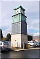
Crompton Parkinson Factory Clock - Netherfield Road
After the factory was demolished c2006 the clock was restored and unveiled in 2010.
Image: © Betty Longbottom
Taken: 2 Nov 2012
0.05 miles
9
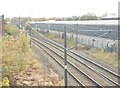
View from Footbridge - off Netherfield Road
Image: © Betty Longbottom
Taken: 2 Nov 2012
0.06 miles
10

Greenshaw Terrace, off Netherfield Road, Guiseley
The narrow street in front of the houses is a public footpath.
Image: © Stephen Craven
Taken: 12 Sep 2020
0.06 miles