IMAGES TAKEN NEAR TO
Silverdale Grove, LEEDS, LS20 8BA
Introduction
This page details the photographs taken nearby to Silverdale Grove, LS20 8BA by members of the Geograph project.
The Geograph project started in 2005 with the aim of publishing, organising and preserving representative images for every square kilometre of Great Britain, Ireland and the Isle of Man.

There are currently over 7.5m images from over14,400 individuals and you can help contribute to the project by visiting https://www.geograph.org.uk
Image Map (Loading...)


Getting Data...Please wait
Leaflet Map data © OpenStreetMap
Images are licensed for reuse under creativecommons.org/licenses/by-sa/2.0
Notes
- Clicking on the map will re-center to the selected point.
- The higher the marker number, the further away the image location is from the centre of the postcode.
Image Listing (91 Images Found)
Images are licensed for reuse under creativecommons.org/licenses/by-sa/2.0
Image
Details
Distance
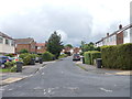
1

Silverdale Crescent - Silverdale Avenue
Image: © Betty Longbottom
Taken: 9 Jul 2012
0.04 miles
2
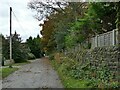
Coach Road, Guiseley
The road is not tarmac surfaced, so probably unadopted but not signed as private.
Image: © Stephen Craven
Taken: 24 Oct 2020
0.06 miles
3
Silverdale Road - Silverdale Avenue
Image: © Betty Longbottom
Taken: 9 Jul 2012
0.07 miles
4
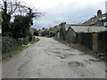
Coach Road, Guiseley
Unmade road leading off Park Road, Guiseley
Image: © Chris Heaton
Taken: 19 Feb 2014
0.08 miles
5

Bransdale Avenue - Silverdale Avenue
Image: © Betty Longbottom
Taken: 9 Jul 2012
0.09 miles
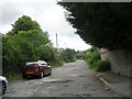
6

Silverdale Avenue - viewed from Silverdale Drive
Image: © Betty Longbottom
Taken: 9 Jul 2012
0.09 miles

9

Silverdale Avenue - viewed from Silverdale Drive
Image: © Betty Longbottom
Taken: 9 Jul 2012
0.10 miles
10

Silverdale Drive - Silverdale Avenue
Image: © Betty Longbottom
Taken: 9 Jul 2012
0.11 miles