IMAGES TAKEN NEAR TO
Church Court, LEEDS, LS19 7SA
Introduction
This page details the photographs taken nearby to Church Court, LS19 7SA by members of the Geograph project.
The Geograph project started in 2005 with the aim of publishing, organising and preserving representative images for every square kilometre of Great Britain, Ireland and the Isle of Man.

There are currently over 7.5m images from over14,400 individuals and you can help contribute to the project by visiting https://www.geograph.org.uk
Image Map (Loading...)


Getting Data...Please wait
Leaflet Map data © OpenStreetMap
Images are licensed for reuse under creativecommons.org/licenses/by-sa/2.0
Notes
- Clicking on the map will re-center to the selected point.
- The higher the marker number, the further away the image location is from the centre of the postcode.
Image Listing (107 Images Found)
Images are licensed for reuse under creativecommons.org/licenses/by-sa/2.0
Image
Details
Distance
1
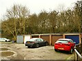
Garages, Church Court, Yeadon (2)
Residents' parking.
Image: © Stephen Craven
Taken: 24 Jan 2021
0.01 miles
2
Garages, Church Court, Yeadon (1)
Residents' parking.
Image: © Stephen Craven
Taken: 24 Jan 2021
0.01 miles
3
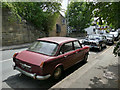
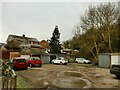
Classic cars, Henshaw Lane, Yeadon
Several cars of the 1960s/1970s, including a Wolseley. A garage (out of shot to the right) specialises in repairing these.
Image: © Stephen Craven
Taken: 14 Jul 2019
0.03 miles
4
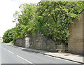
Church Street, Yeadon
Viewed from outside the church itself.
Image: © Stephen Craven
Taken: 24 Jan 2021
0.03 miles
6
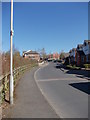
Former railway bridge abutment, Henshaw Lane, Yeadon
Yeadon station was to the right of the road in this view. It was near the terminus of the Midland Railway branch line from Guiseley, and opened in 1894 but never had a regular passenger service, only being used for goods and excursion trains. The ranch closed in 1964 and the bridge over the road was removed in 1969 (source: https://www.aireboroughhistoricalsociety.co.uk/yeadon/henshaw-lane--yeadon.aspx ). A short length of the trackbed to the left of the road is now a walking and cycling route.
Image: © Stephen Craven
Taken: 14 Jul 2019
0.03 miles
7
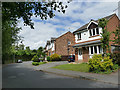
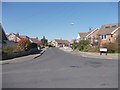
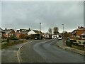
Houses on Parkland View, Yeadon
Relatively modern detached housing (at a guess, 1980s?)
Image: © Stephen Craven
Taken: 14 Jul 2019
0.04 miles
8
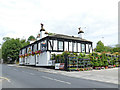
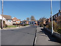
The Station Inn, Henshaw Lane, Yeadon
Named after the nearby Yeadon station which closed in 1964 Image the pub also retains a classic Tetley sign.
Image: © Stephen Craven
Taken: 14 Jul 2019
0.04 miles