IMAGES TAKEN NEAR TO
The Parade, Westfield Drive, LEEDS, LS19 7NW
Introduction
This page details the photographs taken nearby to The Parade, Westfield Drive, LS19 7NW by members of the Geograph project.
The Geograph project started in 2005 with the aim of publishing, organising and preserving representative images for every square kilometre of Great Britain, Ireland and the Isle of Man.

There are currently over 7.5m images from over14,400 individuals and you can help contribute to the project by visiting https://www.geograph.org.uk
Image Map
Images are licensed for reuse under creativecommons.org/licenses/by-sa/2.0
Notes
- Clicking on the map will re-center to the selected point.
- The higher the marker number, the further away the image location is from the centre of the postcode.
Image Listing (59 Images Found)
Images are licensed for reuse under creativecommons.org/licenses/by-sa/2.0
Image
Details
Distance
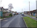
1
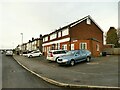
The Parade, Westfield Drive, Yeadon
This looks like a row or 'parade' of shops that have been converted to housing - you can see where the original shop windows have been bricked up.
Image: © Stephen Craven
Taken: 24 Jan 2021
0.01 miles
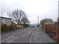
3
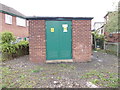
Electricity Substation No 4606 - Westfield Mount
Image: © Betty Longbottom
Taken: 23 Apr 2012
0.01 miles
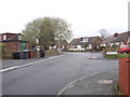
4
Westfield Drive - viewed from Westfield Mount
Image: © Betty Longbottom
Taken: 23 Apr 2012
0.02 miles
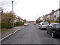
5
Old Whackhouse Lane - Westfield Mount
Image: © Betty Longbottom
Taken: 23 Apr 2012
0.02 miles
6
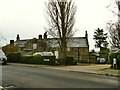
Whack House, Yeadon
Anyone driving along the A65 through Yeadon may have noticed the oddly named Whack House Lane. Well, this is the property shown as Whack House on old maps. A comment on a local history blog suggests it may be derived from "workhouse" although other explanations are possible.
Image: © Stephen Craven
Taken: 24 Jan 2021
0.02 miles
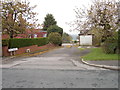
8
Westfield Estate, Yeadon
One view of the estate, from the end of Woodlea Approach.
Image: © Mark Morton
Taken: 22 May 2005
0.05 miles
9
Woodlea Approach - viewed from Woodlea Mount
Image: © Betty Longbottom
Taken: 23 Apr 2012
0.07 miles
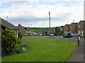
10
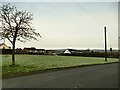
Green space off Old Whack House Lane, Yeadon
It hasn't always been an open space - the 1956 map shows housing here.
Image: © Stephen Craven
Taken: 24 Jan 2021
0.08 miles