
IMAGES TAKEN NEAR TO
New Road, LEEDS, LS19 7HW
Introduction
This page details the photographs taken nearby to New Road, LS19 7HW by members of the Geograph project.
The Geograph project started in 2005 with the aim of publishing, organising and preserving representative images for every square kilometre of Great Britain, Ireland and the Isle of Man.

There are currently over 7.5m images from over14,400 individuals and you can help contribute to the project by visiting https://www.geograph.org.uk
Image Map
Images are licensed for reuse under creativecommons.org/licenses/by-sa/2.0
Notes
- Clicking on the map will re-center to the selected point.
- The higher the marker number, the further away the image location is from the centre of the postcode.
Image Listing (99 Images Found)
Images are licensed for reuse under creativecommons.org/licenses/by-sa/2.0
Image
Details
Distance
1
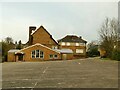
St Peter & St Paul church, Yeadon
This is the rear of the Roman Catholic church, which opened in 1956, and the parish hall. See Image for the front.
Image: © Stephen Craven
Taken: 24 Jan 2021
0.04 miles
2
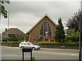
St Peter and St Paul RC Church, New Road, Yeadon
Image: © Rich Tea
Taken: 16 Jun 2004
0.04 miles
3
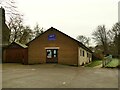
10th Airedale Scouts, Yeadon
The scout hut is at the end of the car park of St Peter & St Paul church.
Image: © Stephen Craven
Taken: 24 Jan 2021
0.04 miles
5
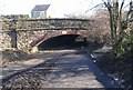
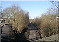
Road Bridge over disused Railway Line - New Road
Image: © Betty Longbottom
Taken: 13 Feb 2008
0.04 miles
6
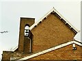
St Peter & St Paul church, Yeadon - belfry
This Roman Catholic church opened in 1956, and has a single bell. See Image for context.
Image: © Stephen Craven
Taken: 24 Jan 2021
0.04 miles
10
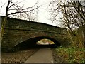
New Road bridge over the Yeadon Cycleway
The cycleway runs for 1.3km from Engine Fields to Ghyll Royd and follows most of the length of the former Yeadon branch of the Midland Railway that closed in 1964. The original cutting must have been partly infilled, as there certainly isn't room for a standard gauge train to fit under the bridge at the present ground level. New Road is the main A65 Leeds to Kendal road.
Image: © Stephen Craven
Taken: 24 Jan 2021
0.07 miles