IMAGES TAKEN NEAR TO
Ackworth Drive, LEEDS, LS19 7BR
Introduction
This page details the photographs taken nearby to Ackworth Drive, LS19 7BR by members of the Geograph project.
The Geograph project started in 2005 with the aim of publishing, organising and preserving representative images for every square kilometre of Great Britain, Ireland and the Isle of Man.

There are currently over 7.5m images from over14,400 individuals and you can help contribute to the project by visiting https://www.geograph.org.uk
Image Map
Images are licensed for reuse under creativecommons.org/licenses/by-sa/2.0
Notes
- Clicking on the map will re-center to the selected point.
- The higher the marker number, the further away the image location is from the centre of the postcode.
Image Listing (103 Images Found)
Images are licensed for reuse under creativecommons.org/licenses/by-sa/2.0
Image
Details
Distance
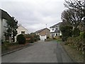
3
Peacock Court, Yeadon
Old maps show the Peacock Inn at this location, and the name lives on.
Image: © Stephen Craven
Taken: 7 Jan 2018
0.04 miles
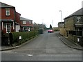
4
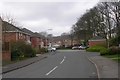
Signs on Moorfield Drive, Rawdon
One of them says "Airport parking prohibited, Residents only". Presumably in the past travellers have tried to avoid airport parking charges by leaving their cars here (about a mile from the airport car park, though there is a bus service).
Image: © Stephen Craven
Taken: 28 Mar 2021
0.04 miles
6
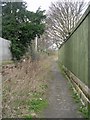
Public footpath from Harrogate Road to Grange Avenue
Image: © Stephen Craven
Taken: 28 Mar 2021
0.05 miles
7
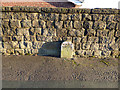
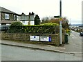
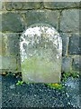
Boundary stone on Harrogate Road
Yeadon to the left, Rawdon to the right. The old borough boundary is now irrelevant, both having been swallowed up by Leeds. But the Biblical injunction against moving such features is still observed.
Image: © Stephen Craven
Taken: 7 Jan 2018
0.07 miles
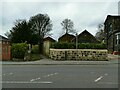
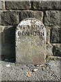
9
Old Boundary Marker by the A658, Harrogate Road, Yeadon
Parish Boundary Marker by the A658, in parish of Carlton (Leeds District), A658 Yeadon, on Harrogate Road 100 metres South of Bayton Lane crossroads, East side of road.
Inscription reads:-
YEA|RAW
DON|DON
Surveyed
Milestone Society National ID: YW_CARYEA02pb
Image: © Milestone Society
Taken: Unknown
0.07 miles
10
Boundary stone on the A658
This is on the boundary between Yeadon and Rawdon.
Image: © Humphrey Bolton
Taken: 30 Sep 2013
0.07 miles