IMAGES TAKEN NEAR TO
Scotland Way, LEEDS, LS18 5SQ
Introduction
This page details the photographs taken nearby to Scotland Way, LS18 5SQ by members of the Geograph project.
The Geograph project started in 2005 with the aim of publishing, organising and preserving representative images for every square kilometre of Great Britain, Ireland and the Isle of Man.

There are currently over 7.5m images from over14,400 individuals and you can help contribute to the project by visiting https://www.geograph.org.uk
Image Map (Loading...)


Getting Data...Please wait
Leaflet Map data © OpenStreetMap
Images are licensed for reuse under creativecommons.org/licenses/by-sa/2.0
Notes
- Clicking on the map will re-center to the selected point.
- The higher the marker number, the further away the image location is from the centre of the postcode.
Image Listing (9 Images Found)
Images are licensed for reuse under creativecommons.org/licenses/by-sa/2.0
Image
Details
Distance
1
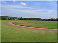
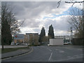
Sportsground at Leeds University
The Sports ground Adjacent to the University of Leeds
Image: © Mick Melvin
Taken: 22 Jun 2005
0.08 miles
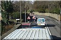
2
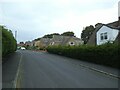
Junction of Argyll Close and Scotland Way, Horsforth
With a postbox on the corner.
Image: © Stephen Craven
Taken: 22 Sep 2020
0.12 miles
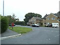
3
Argyll Close, off Scotland Way, Horsforth
A dead-end street.
Image: © Stephen Craven
Taken: 22 Sep 2020
0.13 miles
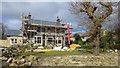
6
Access Lane to Beech House
Access from Scotland Lane, Horsforth - and adopted by a public footpath.
Image: © Chris Heaton
Taken: 27 Jan 2014
0.19 miles
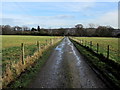
7
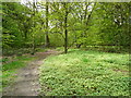
Footpath through Whetstone Plantation, Horsforth
'Wetstone' on the large-scale OS map, but it should presumably be 'Whetstone' like the name of the farm.
Image: © Humphrey Bolton
Taken: 4 May 2019
0.20 miles