
IMAGES TAKEN NEAR TO
St. James Terrace, LEEDS, LS18 5QT
Introduction
This page details the photographs taken nearby to St. James Terrace, LS18 5QT by members of the Geograph project.
The Geograph project started in 2005 with the aim of publishing, organising and preserving representative images for every square kilometre of Great Britain, Ireland and the Isle of Man.

There are currently over 7.5m images from over14,400 individuals and you can help contribute to the project by visiting https://www.geograph.org.uk
Image Map
Images are licensed for reuse under creativecommons.org/licenses/by-sa/2.0
Notes
- Clicking on the map will re-center to the selected point.
- The higher the marker number, the further away the image location is from the centre of the postcode.
Image Listing (103 Images Found)
Images are licensed for reuse under creativecommons.org/licenses/by-sa/2.0
Image
Details
Distance
1
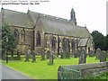
St James' Church, Low Lane, Horsforth
This is on the south-west side of Low Lane, between Lickless Drive and St James Terrace. It is more or less hidden from view by houses and the former primary school.
Image: © Rich Tea
Taken: Unknown
0.03 miles
2
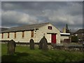
Scout Hut by St James' Church
Just outside the north wall of the churchyard.
Image: © Rich Tea
Taken: 18 Mar 2006
0.03 miles
3
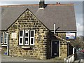
School for Sale
St Margaret's Primary School on Low Lane has recently moved to new buildings on Town Street, so the old buildings are for sale.
Image: © Rich Tea
Taken: 18 Mar 2006
0.03 miles
4
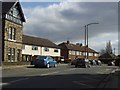
Low Lane
Looking east by St Margaret's School (which is causing the shadow in the foreground).
Image: © Rich Tea
Taken: 18 Mar 2006
0.03 miles
5

Horsforth, Woodside school
The benchmark, which is quite worn, is cut into the roadside wall of the school.
Image: © Mel Towler
Taken: 28 Dec 2021
0.03 miles
6

Horsforth, Woodside school
There is a benchmark, which is quite worn, cut into the roadside wall of the school.
Image: © Mel Towler
Taken: 28 Dec 2021
0.03 miles
7
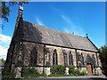
St James's church, Woodside, Horsforth
The church's main entrance is from Low Lane Image but the angle of the sun meant this view of the south side from Lickless Terrace was more feasible. It dates from 1848, by local architect C W Burleigh, and is listed grade II (list entry 1261243).
Image: © Stephen Craven
Taken: 27 Apr 2020
0.04 miles
8
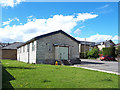
St James's parish centre, Low Lane, Horsforth
The building was principally used as a scout hut some years ago Image but the scouting logo has gone and it is known as the parish centre.
Image: © Stephen Craven
Taken: 27 Apr 2020
0.05 miles
9
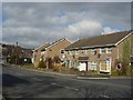
Low Lane at Bridge Wood Close
Looking north-west along Low Lane, with the junction of Bridge Wood Close on the right.
Image: © Rich Tea
Taken: 18 Mar 2006
0.06 miles
10
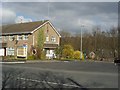
Bridge Wood Close
Looking north across Low Lane
Image: © Rich Tea
Taken: 18 Mar 2006
0.06 miles