IMAGES TAKEN NEAR TO
Church Grove, LEEDS, LS18 5LH

Introduction

This page details the photographs taken nearby to Church Grove, LS18 5LH by members of the Geograph project.

The Geograph project started in 2005 with the aim of publishing, organising and preserving representative images for every square kilometre of Great Britain, Ireland and the Isle of Man.

There are currently over 7.5m images from over14,400 individuals and you can help contribute to the project by visiting https://www.geograph.org.uk

Image Map


Images are licensed for reuse under creativecommons.org/licenses/by-sa/2.0
Notes
  • Clicking on the map will re-center to the selected point.
  • The higher the marker number, the further away the image location is from the centre of the postcode.

Image Listing (314 Images Found)

Images are licensed for reuse under creativecommons.org/licenses/by-sa/2.0
  • ...
Image
Details
Distance
1
Church Grove - viewed from Church Lane
Image: © Betty Longbottom Taken: 22 Aug 2011
0.03 miles
2
Church Crescent, Horsforth
Image: © Mark Anderson Taken: 23 Jun 2012
0.03 miles
3
St. Margaret's Parish Church, Horsforth
Built high on a hill some 100 metres above the Aire valley the spire can be seen for miles around. View taken looking W from the back of Morrison's supermarket.
Image: © michael ely Taken: 24 Nov 2005
0.04 miles
4
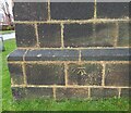
Horsforth, St Margaret's church
The benchmark is cut into the south-east face of the tower.
Image: © Mel Towler Taken: 28 Dec 2021
0.04 miles
5
Horsforth, St Margaret's church
There is a benchmark cut into the south-east face of the tower.
Image: © Mel Towler Taken: 28 Dec 2021
0.04 miles
6
Church Crescent - off Church Lane
Image: © Betty Longbottom Taken: 22 Aug 2011
0.04 miles
7
Bus layby, Church Road, Horsforth
With a puffin crossing just beyond it.
Image: © Stephen Craven Taken: 11 Jun 2021
0.05 miles
8
Town Street, Horsforth. Looking south-west.
The street on the left, labelled 'Feast Field', now leads to new houses, but they are built on a field that, until after WWII, was used for the annual fair, known locally as the'feast'.
Image: © Dr Neil Clifton Taken: 15 Apr 1999
0.05 miles
9
Town Street, Horsforth
Looking south-west
Image: © Dr Neil Clifton Taken: 15 Apr 1999
0.06 miles
10
Hall Park Rise - Hall Park Avenue
Image: © Betty Longbottom Taken: 22 Aug 2011
0.06 miles
  • ...