IMAGES TAKEN NEAR TO
West End Drive, LEEDS, LS18 5JZ
Introduction
This page details the photographs taken nearby to West End Drive, LS18 5JZ by members of the Geograph project.
The Geograph project started in 2005 with the aim of publishing, organising and preserving representative images for every square kilometre of Great Britain, Ireland and the Isle of Man.

There are currently over 7.5m images from over14,400 individuals and you can help contribute to the project by visiting https://www.geograph.org.uk
Image Map
Images are licensed for reuse under creativecommons.org/licenses/by-sa/2.0
Notes
- Clicking on the map will re-center to the selected point.
- The higher the marker number, the further away the image location is from the centre of the postcode.
Image Listing (68 Images Found)
Images are licensed for reuse under creativecommons.org/licenses/by-sa/2.0
Image
Details
Distance
1
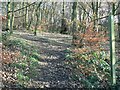
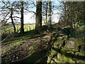
Leeds Country Way, Hunger Hills, Horsforth
The sign marks the Leeds Country Way as it skirts the western edge of Horsforth
Image: © Rich Tea
Taken: 2 Dec 2006
0.06 miles
2
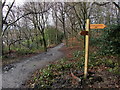
Fingerpost on Hunger Hills
Freshly erected fingerpost in the woods on Hunger Hills, Horsforth - indicating the direction of the Leeds Country Way.
Image: © Chris Heaton
Taken: 27 Jan 2014
0.07 miles
3
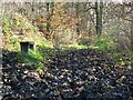
Mud!
Who would try to sit on the bench, where the footpath has been churned up by walkers and horses?
Image: © Rich Tea
Taken: 2 Dec 2006
0.07 miles
4
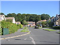
Hunger Hills Drive - Hunger Hills Avenue
Image: © Betty Longbottom
Taken: 22 Aug 2011
0.08 miles
5
Footbridge over a little stream, Horsforth
If you take the path on the right you can step over the stream, but I expect the bridge is necessary sometimes, after heavy rain.
Image: © Humphrey Bolton
Taken: 4 May 2019
0.09 miles
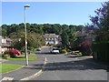
6
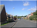
Hunger Hills Drive - West End Drive
Image: © Betty Longbottom
Taken: 22 Aug 2011
0.10 miles
7
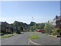
West End Drive - viewed from Hunger Hills Drive
Image: © Betty Longbottom
Taken: 22 Aug 2011
0.10 miles
8
West End Drive - viewed from Hunger Hills Drive
Image: © Betty Longbottom
Taken: 22 Aug 2011
0.11 miles
9
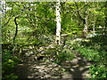
Footpath among beech trees, Hunger Hills, Horsforth
This footpath runs south from Lee Lane West, within a belt of trees, mainly beech.
Image: © Rich Tea
Taken: 2 Dec 2006
0.12 miles
10
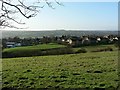
Fields on the Hunger Hills
Looking from a footpath across the fields. The houses are on West Pasture Close Image, with West End Primary School Image to the left.
In the distance to the right is Calverley Image on the other side of the Aire Valley.
Image: © Rich Tea
Taken: 2 Dec 2006
0.12 miles