IMAGES TAKEN NEAR TO
The Avenue, LEEDS, LS18 5JW
Introduction
This page details the photographs taken nearby to The Avenue, LS18 5JW by members of the Geograph project.
The Geograph project started in 2005 with the aim of publishing, organising and preserving representative images for every square kilometre of Great Britain, Ireland and the Isle of Man.

There are currently over 7.5m images from over14,400 individuals and you can help contribute to the project by visiting https://www.geograph.org.uk
Image Map
Images are licensed for reuse under creativecommons.org/licenses/by-sa/2.0
Notes
- Clicking on the map will re-center to the selected point.
- The higher the marker number, the further away the image location is from the centre of the postcode.
Image Listing (115 Images Found)
Images are licensed for reuse under creativecommons.org/licenses/by-sa/2.0
Image
Details
Distance
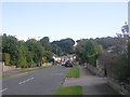
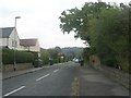
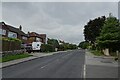
2
West End Lane - viewed from The Avenue
Image: © Betty Longbottom
Taken: 10 Sep 2011
0.06 miles
3
West End Lane - viewed from The Avenue
Image: © Betty Longbottom
Taken: 10 Sep 2011
0.06 miles
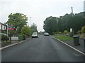
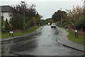
5
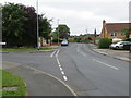
Hall Lane in Horsforth at its junction with West End Rise
Looking north-eastward.
Image: © Peter Wood
Taken: 25 Jul 2017
0.07 miles
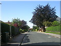
6
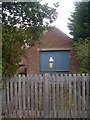
Electricity Substation No 4596 - West End Rise
Image: © Betty Longbottom
Taken: 10 Sep 2011
0.07 miles
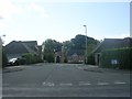
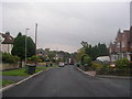
8
West End Rise
A street in Horsforth in the West End area.
Image: © DS Pugh
Taken: 14 Sep 2024
0.07 miles
9
West End Rise, Horsforth
Viewed from Hall Lane.
Image: © Mark Anderson
Taken: 13 Oct 2016
0.07 miles