
IMAGES TAKEN NEAR TO
Scotland Lane, LEEDS, LS18 5HW
Introduction
This page details the photographs taken nearby to Scotland Lane, LS18 5HW by members of the Geograph project.
The Geograph project started in 2005 with the aim of publishing, organising and preserving representative images for every square kilometre of Great Britain, Ireland and the Isle of Man.

There are currently over 7.5m images from over14,400 individuals and you can help contribute to the project by visiting https://www.geograph.org.uk
Image Map
Images are licensed for reuse under creativecommons.org/licenses/by-sa/2.0
Notes
- Clicking on the map will re-center to the selected point.
- The higher the marker number, the further away the image location is from the centre of the postcode.
Image Listing (20 Images Found)
Images are licensed for reuse under creativecommons.org/licenses/by-sa/2.0
Image
Details
Distance
1
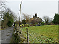
Owlet Grange
One of a collection of properties along with Tanhouse Cottage and Owlet Farm which on older large scale maps (pre-1940s) are collectively labelled as Scotland; that place name seems now to be applied to the properties on Scotland Lane itself.
Image: © Stephen Craven
Taken: 25 Dec 2018
0.01 miles
2
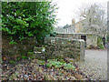
Disused stone stile at Owlet Grange
The presence of this stile close to a gateway with a more recent looking gatepost suggests that the stile pre-dates the gateway, as it now serves no purpose.
Image: © Stephen Craven
Taken: 25 Dec 2018
0.02 miles
3
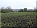
Muddy field below Owlet Grange
This field was bad for walking but there was worse to come... Image
Image: © Stephen Craven
Taken: 25 Dec 2018
0.04 miles
4
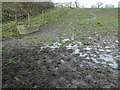
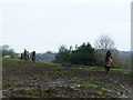
Very muddy field at Owlet Farm
There is supposed to be a public footpath here. We had just crossed one muddy field Image but gave up at this one, which would have needed Wellington boots. The reason for this slough is the drinking trough, used by the horses, combined with it being the lowest corner of the field to which rainwater will drain.
Image: © Stephen Craven
Taken: 25 Dec 2018
0.06 miles
5
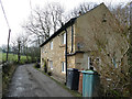
Tanhouse Cottage
Now a single large property, but a blocked doorway evidences that it was once a pair of smaller cottages. It appears on the 1851 O.S. map, along with others along the lane that have since been demolished.
Image: © Stephen Craven
Taken: 25 Dec 2018
0.06 miles
7
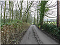
The road to Scotland
This unmetalled track (also a public footpath) leaves Scotland Lane to head eastwards towards a collection of properties which on modern maps are called Tanhouse Cottage, Owlet Farm and Owlet Grange, but on older large scale maps (pre-1940s) are collectively labelled as Scotland; that place name seems now to be applied to the properties on Scotland Lane itself. See also Image (2007).
Image: © Stephen Craven
Taken: 25 Dec 2018
0.12 miles
8
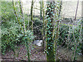
Scotland Beck near Horsforth
Viewed from Scotland Lane; I wonder which gave its name to the other? There's also Scotland Wood a few miles east of here, so the name must have some local significance.
Image: © Stephen Craven
Taken: 9 Dec 2018
0.15 miles
9
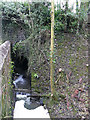
Scotland Beck emerges from under Scotland Lane
The beck runs under the road in a circular culvert.
Image: © Stephen Craven
Taken: 25 Dec 2018
0.15 miles
10
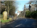
Scotland
Scotland Lane as it passes through the hamlet of Scotland, by the entrance to Moor Grange Farm.
Image: © Rich Tea
Taken: 3 Feb 2007
0.16 miles