
IMAGES TAKEN NEAR TO
Wood Bottom Walk, LEEDS, LS18 4TU
Introduction
This page details the photographs taken nearby to Wood Bottom Walk, LS18 4TU by members of the Geograph project.
The Geograph project started in 2005 with the aim of publishing, organising and preserving representative images for every square kilometre of Great Britain, Ireland and the Isle of Man.

There are currently over 7.5m images from over14,400 individuals and you can help contribute to the project by visiting https://www.geograph.org.uk
Image Map
Images are licensed for reuse under creativecommons.org/licenses/by-sa/2.0
Notes
- Clicking on the map will re-center to the selected point.
- The higher the marker number, the further away the image location is from the centre of the postcode.
Image Listing (149 Images Found)
Images are licensed for reuse under creativecommons.org/licenses/by-sa/2.0
Image
Details
Distance
1
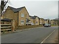
Low Hall Road
Housing on the new Horsforth Vale estate built on the site of the former Woodbottom mill (originally built in 1797, as Low Mill).
Image: © Stephen Craven
Taken: 7 Mar 2021
0.01 miles
2
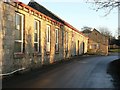
Woodbottom Mills
An old mill building tucked away down the very quiet Low Hall Road.
During the 1980's and 1990's the building was occupied by William Irwin Builders (thanks to one of their former employees, Mandie Paxton, for the information).
By 2016, it had been demolished, see Image
Image: © Rich Tea
Taken: 23 Dec 2007
0.02 miles
3

Low Hall Road and the former Woodbottom Mills
Woodbottom Mills was on the site behind the fencing on the left (and can be seen from the same position in 2007 Image). It was demolished after 2011, probably 2012 or 2013 judging by the growth of buddleia bushes in the site. Signs indicate that 60 houses will be built on the site by Redrow Homes.
Image: © Rich Tea
Taken: 13 Mar 2016
0.02 miles
4
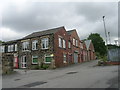
Woodbottom Mills - off Low Hall Road
Image: © Betty Longbottom
Taken: 13 Jun 2011
0.02 miles
5
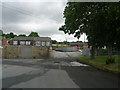
Footpath - Low Hall Road
This passes through Woodbottom Mills.
Image: © Betty Longbottom
Taken: 13 Jun 2011
0.03 miles
6
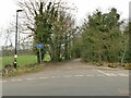
The bottom of Knott Lane
The sign says "unsuitable for motor vehicles" and in fact there is now a traffic barrier a few hundred metres along the lane Image
Image: © Stephen Craven
Taken: 7 Mar 2021
0.04 miles
7
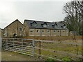
Woodbottom View
Part of the new Horsforth Vale estate, these houses are built on the site of the former mill pond so I hope the foundations are well made.
Image: © Stephen Craven
Taken: 7 Mar 2021
0.05 miles
8
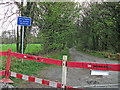
Knott Lane, Wellroyd
This is the southern end of the lane with a broken surface - hence the sign. The surface improves where the lane passes the crematorium to eventually meet the A65 at Rawdon.
Image: © michael ely
Taken: 15 Apr 2011
0.05 miles
9
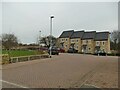
Woodbottom Gardens
Part of the new Horsforth Vale estate.
Image: © Stephen Craven
Taken: 7 Mar 2021
0.05 miles
10
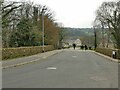
Mill Square
Not really a square, just the name given to this road on the new Horsforth Vale estate. It was formerly a track that led to a mill pond.
Image: © Stephen Craven
Taken: 7 Mar 2021
0.05 miles