
IMAGES TAKEN NEAR TO
Broadway, LEEDS, LS18 4RS
Introduction
This page details the photographs taken nearby to Broadway, LS18 4RS by members of the Geograph project.
The Geograph project started in 2005 with the aim of publishing, organising and preserving representative images for every square kilometre of Great Britain, Ireland and the Isle of Man.

There are currently over 7.5m images from over14,400 individuals and you can help contribute to the project by visiting https://www.geograph.org.uk
Image Map
Images are licensed for reuse under creativecommons.org/licenses/by-sa/2.0
Notes
- Clicking on the map will re-center to the selected point.
- The higher the marker number, the further away the image location is from the centre of the postcode.
Image Listing (421 Images Found)
Images are licensed for reuse under creativecommons.org/licenses/by-sa/2.0
Image
Details
Distance
1
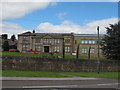
Broadway Hall, Horsforth
According to the Leodis website, this property was built in 1805 for Jonathan Staples, a local surgeon and known as Lower Bank House. It was renamed Broadway Hall in the 1930s when it became a ballroom and function suite. In 1966 the building was bought by Bartlett insurance brokers who are still based here. I am surprised it is not listed.
Image: © Stephen Craven
Taken: 14 Aug 2016
0.00 miles
2
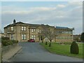
Broadway Hall, Horsforth
According to the Leodis website, this property was built in 1805 for Jonathan Staples, a local surgeon and known as Lower Bank House. It was renamed Broadway Hall in the 1930s when it became a ballroom and function suite. In 1966 the building was bought by Bartlett insurance brokers who are still based here. I am surprised it is not listed. See Image for a view from a different angle and Image for a photo taken in 2006.
Image: © Stephen Craven
Taken: 6 Mar 2021
0.01 miles
3
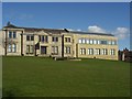
Broadway Hall, Broadway, Horsforth
The headquarters of the Bartlett Insurance Group. Their website says the original building was erected in 1805 for a local surgeon.
See also Image
Image: © Rich Tea
Taken: 5 Mar 2006
0.01 miles
4
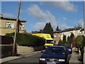
Bank Avenue, Horsforth
Looking north from Broadway (the Ring Road) on the day someone was moving house.
Image: © Rich Tea
Taken: 28 Feb 2006
0.02 miles
5
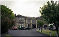
Broadway Hall, Horsforth, Yorkshire
Although now used as offices, (and greatly extended since this photograph), during WWII this building was used as a dance hall, which managed to keep going with Saturday night dances in spite of the blackout restrictions. The dances scandalised the neighbourhood, but they were extremely popular, and local bus operator Samuel Ledgard, never averse to turning an honest penny, usually managed to find enough petrol and an old 'chara' or two to get folks home to Rawdon, Yeadon and Guiseley afterwards. Those from Hawksworth Estate had to walk.
Image: © Dr Neil Clifton
Taken: 1 Jun 1999
0.02 miles
6
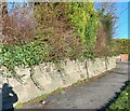
Horsforth, 336 Broadway
According to the OS benchmark database there is a benchmark cut into this roadside wall which is the boundary wall to number 336, and is on the north side of the road. Nothing was found.
Image: © Mel Towler
Taken: 16 Jan 2023
0.04 miles
7
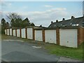
Lock-up garages, Stoney Lane, Horsforth
Image: © Stephen Craven
Taken: 6 Mar 2021
0.04 miles
8
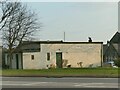
HAGA, Broadway
Horsforth Allotments and Gardens Association has its base by the ring road.
Image: © Stephen Craven
Taken: 6 Mar 2021
0.05 miles
9
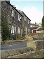
Stoney Lane, Horsforth
Looking north from Broadway (the Ring Road)
Image: © Rich Tea
Taken: 28 Feb 2006
0.05 miles
10
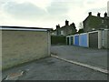
Lock-up garages, Stoney Lane, Horsforth
There is another row of them facing opposite.
Image: © Stephen Craven
Taken: 6 Mar 2021
0.06 miles