IMAGES TAKEN NEAR TO
Newlay Wood Crescent, LEEDS, LS18 4LW
Introduction
This page details the photographs taken nearby to Newlay Wood Crescent, LS18 4LW by members of the Geograph project.
The Geograph project started in 2005 with the aim of publishing, organising and preserving representative images for every square kilometre of Great Britain, Ireland and the Isle of Man.

There are currently over 7.5m images from over14,400 individuals and you can help contribute to the project by visiting https://www.geograph.org.uk
Image Map
Images are licensed for reuse under creativecommons.org/licenses/by-sa/2.0
Notes
- Clicking on the map will re-center to the selected point.
- The higher the marker number, the further away the image location is from the centre of the postcode.
Image Listing (296 Images Found)
Images are licensed for reuse under creativecommons.org/licenses/by-sa/2.0
Image
Details
Distance
1
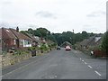
Newlay Wood Crescent - viewed from Newlay Wood Avenue
Image: © Betty Longbottom
Taken: 6 Jun 2011
0.03 miles
2
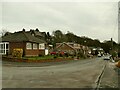
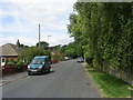
Newlay Wood Crescent
A road of probably post-WW2 housing.
Image: © Stephen Craven
Taken: 13 Feb 2021
0.03 miles
3
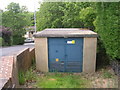
Electricity Substation No 4602 - Newlay Wood Close
Image: © Betty Longbottom
Taken: 6 Jun 2011
0.05 miles
4
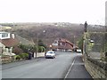
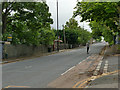
Throstle Nest View, Horsforth
View south from New Road Side
Image: © Rich Tea
Taken: 28 Feb 2006
0.05 miles
5
Newlay Wood Drive - off New Road Side
Image: © Betty Longbottom
Taken: 6 Jun 2011
0.05 miles
6
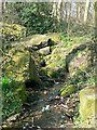
A spring in The Outwood
This spring rises in The Outwood and the water runs about 200 metres downhill into Kirkstall Forge Goit.
Image: © Rich Tea
Taken: 25 Mar 2007
0.06 miles
7
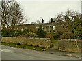
Throstle Nest Farm, Newlay Wood Drive
The row of stone cottages is named "Throstle Nest Farm" though whether it ever was a farmhouse is doubtful: on the oldest large scale map available online (1893) it's named as Throstle Nest Cottage (Throstle Nest being a large house a short way to the east).
Image: © Stephen Craven
Taken: 13 Feb 2021
0.06 miles
8
Skateboarding down the A65
Even with the reduced traffic in the Covid-19 restrictions, skateboarding in the middle of a traffic lane of a 40mph main road is not the safest way to travel.
Image: © Stephen Craven
Taken: 7 Jun 2020
0.07 miles
9
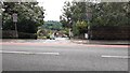
Junction of Throstle Nest View from A65 (New Road Side)
Image: © Luke Shaw
Taken: 24 Jul 2023
0.07 miles
10
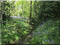
Stream through Outwood, with bluebells
A minor stream within the woods.
The spring of 2016 was particularly good for bluebells after a wet winter.
Image: © Stephen Craven
Taken: 8 May 2016
0.08 miles