
IMAGES TAKEN NEAR TO
Salmon Crescent, LEEDS, LS18 4ET
Introduction
This page details the photographs taken nearby to Salmon Crescent, LS18 4ET by members of the Geograph project.
The Geograph project started in 2005 with the aim of publishing, organising and preserving representative images for every square kilometre of Great Britain, Ireland and the Isle of Man.

There are currently over 7.5m images from over14,400 individuals and you can help contribute to the project by visiting https://www.geograph.org.uk
Image Map
Images are licensed for reuse under creativecommons.org/licenses/by-sa/2.0
Notes
- Clicking on the map will re-center to the selected point.
- The higher the marker number, the further away the image location is from the centre of the postcode.
Image Listing (172 Images Found)
Images are licensed for reuse under creativecommons.org/licenses/by-sa/2.0
Image
Details
Distance
1
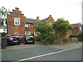
Houses on King Edward Crescent, Horsforth
The stepped gables and hexagonal ground-floor window are quite distinctive, although there are several other example like this on the same estate.
Image: © Stephen Craven
Taken: 2 Jun 2020
0.03 miles
2
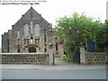
St Mary's RC Church, Broadgate Lane, Horsforth
On the north side of Broadgate Lane between King George Road and Church Avenue
Image: © Rich Tea
Taken: Unknown
0.04 miles
3
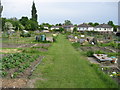
Broadgate Lane Allotments
Allotments in Horsforth, Leeds.
Image: © Chris Heaton
Taken: 25 May 2008
0.04 miles
4
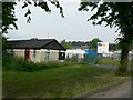
Stanhope Centre, Stanhope Drive, Horsforth
A local community centre. Behind it, a temporary builders depot, for the work being carried out on council houses in the area. This building was first erected in 1940 as a day-nursery, to encourage young mothers to go to work, especially in the munitions industry and other war-work.
Image: © Rich Tea
Taken: 25 Jun 2006
0.05 miles
5
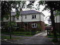
11 Stanhope Drive, Horsforth, Yorkshire
Stanhope Drive was laid out in the late 1920's by the former Horsforth UDC as a tree-lined memorial avenue, with one tree dedicated to each of the 211 men and one woman of Horsforth who perished in World War I. Nearly all of the small metal plates which were provided at the base of each tree have long disappeared and the erstwhile Council houses are now in private hands. Many have been modernised as no 11 here which has UPVC windows and a new roof.
Image: © Dr Neil Clifton
Taken: 24 Jun 2006
0.06 miles
6
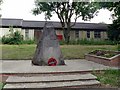
War Memorial, Stanhope Drive, Horsforth
The trees on Stanhope Drive commemorate the 211 men and 1 woman who died in the Great War.
The dead of both world wars are listed on the war memorial at the corner of Broadway and Fink Hill by Horsforth Hall Park.
See Image]
Image: © Rich Tea
Taken: 25 Jun 2006
0.06 miles
7
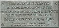
Plaque on War Memorial, Stanhope Drive, Horsforth
Image: © Rich Tea
Taken: 25 Jun 2006
0.06 miles
8
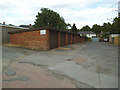
Lock-up garages, Drury Avenue, Horsforth
Image: © Stephen Craven
Taken: 2 Jun 2020
0.07 miles
9
King Edward Avenue, Horsforth
At the end of this short road is an area of allotments. Although the gate was unlocked, I was refused permission to photograph the allotments because "the rules don't allow it". I didn't argue.
Image: © Stephen Craven
Taken: 2 Jun 2020
0.08 miles
10
King Edward Crescent - King Edward Avenue
Image: © Betty Longbottom
Taken: 19 Aug 2011
0.08 miles