
IMAGES TAKEN NEAR TO
Ring Road, LEEDS, LS18 4EL
Introduction
This page details the photographs taken nearby to Ring Road, LS18 4EL by members of the Geograph project.
The Geograph project started in 2005 with the aim of publishing, organising and preserving representative images for every square kilometre of Great Britain, Ireland and the Isle of Man.

There are currently over 7.5m images from over14,400 individuals and you can help contribute to the project by visiting https://www.geograph.org.uk
Image Map
Images are licensed for reuse under creativecommons.org/licenses/by-sa/2.0
Notes
- Clicking on the map will re-center to the selected point.
- The higher the marker number, the further away the image location is from the centre of the postcode.
Image Listing (111 Images Found)
Images are licensed for reuse under creativecommons.org/licenses/by-sa/2.0
Image
Details
Distance
2
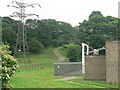
Electricity Substation by Ring Road Horsforth
Image: © Rich Tea
Taken: 25 Jun 2006
0.02 miles
3
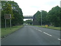
A6120 passing under the Leeds to Harrogate railway
Image: © Colin Pyle
Taken: 31 May 2019
0.02 miles
4
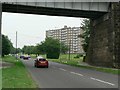
View under railway bridge, Leeds Ring Road, West Park
Looking from the Horsforth side of the bridge, at the flats by Fillingfir Drive.
See the view from the other side Image]
Image: © Rich Tea
Taken: 25 Jun 2006
0.03 miles
5
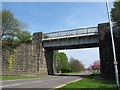
Rail bridge over the Leeds ring road (2)
An opening had to be made in an existing railway embankment dating from 1848 to allow the later 20th century ring road (A6120) to pass through, which explains why the bridge is a steel girder design rather than a stone arch as elsewhere on the line. This view is from the west side. SeeImage for a view looking from a train on the bridge back over the road.
Image: © Stephen Craven
Taken: 8 May 2016
0.03 miles
6
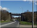
Railway Bridge over Ring Road, Horsforth / West Park
The railway bridge over the ring road, which is not in Horsforth as it is the wrong side of Oil Mill Beck (which was just behind me). So it's really in West Park or even Ireland Wood.
Image: © Rich Tea
Taken: 1 Mar 2006
0.03 miles
7
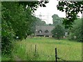
Footpath by Clayton Woods, Ireland Wood, Leeds
Looking towards the Ring Road. The railway line is behind the trees on the left.
Image: © Rich Tea
Taken: 25 Jun 2006
0.03 miles
9
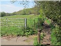
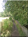
Bollard at the start of a footpath
The footpath leads off the Leeds ring road (A6120) towards Horsforth village. See also Image The purpose of the bollard is unclear since the path is not wide enough for vehicles anyway.
Image: © Stephen Craven
Taken: 8 May 2016
0.03 miles
10
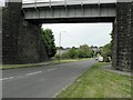
View west under railway bridge, Leeds Ring Road, West Park
Looking in the opposite direction to Image]
Image: © Rich Tea
Taken: 26 May 2008
0.03 miles