IMAGES TAKEN NEAR TO
New Road Side, LEEDS, LS18 4DU

Introduction

This page details the photographs taken nearby to New Road Side, LS18 4DU by members of the Geograph project.

The Geograph project started in 2005 with the aim of publishing, organising and preserving representative images for every square kilometre of Great Britain, Ireland and the Isle of Man.

There are currently over 7.5m images from over14,400 individuals and you can help contribute to the project by visiting https://www.geograph.org.uk

Image Map


Images are licensed for reuse under creativecommons.org/licenses/by-sa/2.0
Notes
  • Clicking on the map will re-center to the selected point.
  • The higher the marker number, the further away the image location is from the centre of the postcode.

Image Listing (214 Images Found)

Images are licensed for reuse under creativecommons.org/licenses/by-sa/2.0
  • ...
Image
Details
Distance
1
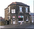
doms diner - New Road Side
Image: © Betty Longbottom Taken: 30 Nov 2009
0.01 miles
2
Kingdom Hall, Calverley Lane, Horsforth
See also Image - since the earlier photo the entrance canopy looks to have been glazed in.
Image: © Stephen Craven Taken: 10 Jan 2021
0.01 miles
3
Kingdom Hall of Jehovahs Witnesses, CalverleyLane, Horsforth
Image: © Rich Tea Taken: Unknown
0.02 miles
4
Manor Road, Horsforth
Seen across New Road Side
Image: © Rich Tea Taken: 15 Apr 2006
0.03 miles
5
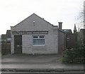
7th Airedale St Margaret's Scouts & Guides - New Road Side
Image: © Betty Longbottom Taken: 30 Nov 2009
0.03 miles
6
New Road Side, Horsforth
No, I wasn't driving a car, I was crossing the road when I took this.
Image: © Rich Tea Taken: 15 Apr 2006
0.03 miles
7
Postbox on Calverley Lane, Horsforth
Just outside the Kingdom Hall Image and next to a sign marking the end of a 20mph residential zone.
Image: © Stephen Craven Taken: 10 Jan 2021
0.03 miles
8
Houses on Manor Road, Horsforth
The road originally formed part of the route between the ancient settlements of Horsforth and Calverley.
Image: © Stephen Craven Taken: 10 Jan 2021
0.04 miles
9
Burger King - New Road Side
A not so fast food outlet!
Image: © Betty Longbottom Taken: 18 Feb 2008
0.04 miles
10
Esso Garage & Burger King, New Road Side, Horsforth
Looking across New Road Side, by the junction of Manor Road. Leeds Ring Road (Broadway) is on the far side of the garage, and the roundabout where it crosses New Road Side (the A65) is just beyond the pedestrian crossing at the left of the picture. Since this picture was taken in 2006, Burger King has been replaced by KFC (sometime between 2008 and 2012) and the Esso petrol station was demolished and new buildings erected between 2016 and 2017 - see Image
Image: © Rich Tea Taken: 15 Apr 2006
0.04 miles
  • ...