
IMAGES TAKEN NEAR TO
Broadgate Lane, LEEDS, LS18 4AG
Introduction
This page details the photographs taken nearby to Broadgate Lane, LS18 4AG by members of the Geograph project.
The Geograph project started in 2005 with the aim of publishing, organising and preserving representative images for every square kilometre of Great Britain, Ireland and the Isle of Man.

There are currently over 7.5m images from over14,400 individuals and you can help contribute to the project by visiting https://www.geograph.org.uk
Image Map
Images are licensed for reuse under creativecommons.org/licenses/by-sa/2.0
Notes
- Clicking on the map will re-center to the selected point.
- The higher the marker number, the further away the image location is from the centre of the postcode.
Image Listing (187 Images Found)
Images are licensed for reuse under creativecommons.org/licenses/by-sa/2.0
Image
Details
Distance
1
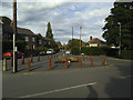
Broadgate Lane, Horsforth
Viewed from the junction with King Edward Avenue.
Image: © Stephen Craven
Taken: 2 Jun 2020
0.01 miles
2
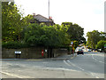
Junction of Broadgate Lane and North Broadgate Lane
Broadgate Lane (quite an old route) bears left here, while the more recent North Broadgate Lane carries almost straight on. Not the postbox in the wall.
Image: © Stephen Craven
Taken: 2 Jun 2020
0.01 miles
3
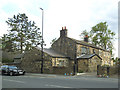
Older houses, Broadgate Lane, Horsforth
These look to be rather other than the other houses in the area, or the church across the road.
Image: © Stephen Craven
Taken: 2 Jun 2020
0.02 miles
4

Spider stones, Broadgate Lane, Horsforth
Presumably painted by children as a 'lockdown' project, these were on the pavement outside some houses Image
Image: © Stephen Craven
Taken: 2 Jun 2020
0.03 miles
5
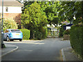
King Edward Avenue, Horsforth
At the end of this short road is an area of allotments. Although the gate was unlocked, I was refused permission to photograph the allotments because "the rules don't allow it". I didn't argue.
Image: © Stephen Craven
Taken: 2 Jun 2020
0.03 miles
6
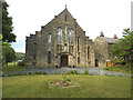
St Mary's church, Horsforth
This Roman Catholic church, opened in 1926, is in the parish of Our Lady of Kirkstall.
Image: © Stephen Craven
Taken: 2 Jun 2020
0.04 miles
7
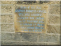
St Mary's church, Horsforth - consecration stone
The stone records the consecration of the church by Bishop Joseph Cowgill on 25 May 1926. For context see Image
Image: © Stephen Craven
Taken: 2 Jun 2020
0.04 miles
8
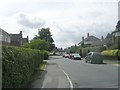
King Edward Avenue - Broadgate Lane
Image: © Betty Longbottom
Taken: 19 Aug 2011
0.04 miles
9
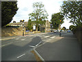
Zebra crossing, Broadgate Lane, Horsforth
The crossing is outside the Catholic school Image
Image: © Stephen Craven
Taken: 2 Jun 2020
0.04 miles
10
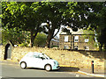
St Mary's Presbytery, Horsforth
The clergy house is adjacent to the church Image
Image: © Stephen Craven
Taken: 2 Jun 2020
0.04 miles