
IMAGES TAKEN NEAR TO
Weardley Lane, LEEDS, LS17 9LS
Introduction
This page details the photographs taken nearby to Weardley Lane, LS17 9LS by members of the Geograph project.
The Geograph project started in 2005 with the aim of publishing, organising and preserving representative images for every square kilometre of Great Britain, Ireland and the Isle of Man.

There are currently over 7.5m images from over14,400 individuals and you can help contribute to the project by visiting https://www.geograph.org.uk
Image Map
Images are licensed for reuse under creativecommons.org/licenses/by-sa/2.0
Notes
- Clicking on the map will re-center to the selected point.
- The higher the marker number, the further away the image location is from the centre of the postcode.
Image Listing (26 Images Found)
Images are licensed for reuse under creativecommons.org/licenses/by-sa/2.0
Image
Details
Distance
2
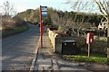
Bus stop, Weardley Lane
On the right is Elizabeth II postbox LS17 865.
Image: © Derek Harper
Taken: 26 Dec 2016
0.02 miles
4
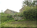
Coronation bench facing Weardley Lane
The bench marks the coronation of Queen Elizabeth II in June 1953. If this is the original, it's in remarkably good condition after 67 years, like the monarch herself.
Image: © Stephen Craven
Taken: 23 Jun 2020
0.04 miles
5
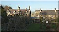
Low Weardley
A pair of semis with lots of gables, and a terrace, on the north side of Weardley Lane.
Image: © Derek Harper
Taken: 26 Dec 2016
0.04 miles
6
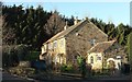
Cottages at Low Weardley
With a plantation on Rawden Hill behind.
Image: © Derek Harper
Taken: 26 Dec 2016
0.07 miles
7
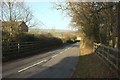
Weardley Lane
From near the junction with Bridleway HAREWOOD 12, dropping past houses at Low Weardley into the Wharfe valley.
Image: © Derek Harper
Taken: 26 Dec 2016
0.07 miles
8

Low Weardley
Also, High Weardley is just visible.
Image: © Steve Partridge
Taken: 11 Nov 2007
0.09 miles
9

Weardley Lane
Further along Image] as it takes a bend. The signs across the field are on the A659 Otley Road, in Image Trees along the River Wharfe can be seen a couple of fields beyond.
Image: © Derek Harper
Taken: 26 Dec 2016
0.11 miles
10
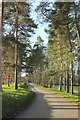
Metalled bridleway to Weardley
Bridleway HAREWOOD 12 follows the road from Stank and Ledy Bridge through a grove of pines to join Weardley Lane.
Image: © Derek Harper
Taken: 26 Dec 2016
0.13 miles